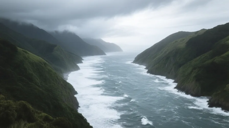
 Cook Strait · AI landscape illustration · Artistic impression
Natural feature · Oceania
Cook Strait
Also known as Te Moana-o-Raukawa
The strait between New Zealand's North and South Islands, at the narrowest point about 22 kilometres across.
Saved in this browser — no account needed. Sign in later and it comes with you.
Where it is
Cook Strait — Te Moana-o-Raukawa — separates New Zealand's North and South Islands, about 22 kilometres across at its narrowest. It is notoriously rough: the Tasman Sea and the Pacific meet here, tidal flows run hard through a constriction, and the surrounding mountains funnel wind into it. The strait sits on an active plate boundary, and the seabed is cut by a deep submarine canyon.
The land and water around it
The Marlborough Soundsharbour
Drowned valleys at the strait's southern side, forming a maze of sheltered waterways. The ferry route threads through them, which is why the crossing ends in calm water however rough the middle was.
The Cook Strait canyonbasin
A deep submarine canyon cutting through the strait, part of the system carrying sediment off the continental shelf. It contributes to the strait's strong and complicated currents.
The plate boundarymountains
The Australian and Pacific plates meet through this region, which is why both coasts are mountainous and why Wellington sits on a fault.
Its history, in short
Māori navigation and settlement crossed and used this strait for centuries before European arrival, and its Māori name and the traditions attached to it long predate the English one. James Cook passed through in 1770 and it took his name in European usage. It has since been the country's principal transport bottleneck — everything moving between the islands goes by ferry or by air — and the site of New Zealand's worst modern maritime disaster.
Timeline
Dates are shown on a timeline rather than as changing shapes on the map. The globe draws modern boundaries only, and tinting a modern outline to stand for a historical one would state something we cannot source.
Post-classical world
c. 13th–14th centuries
Crossed and settled
Māori settlement extends across both sides of the strait, which is a route rather than a barrier for people who arrived by ocean voyaging. Traditions attached to the strait and its name long predate European contact.
Approximate dateEncyclopædia Britannica
Early modern & oceanic
1770
Cook passes through
James Cook sails the strait and it takes his name in European usage. Māori had been using it for centuries, and Te Moana-o-Raukawa is the older name.
Well attestedEncyclopædia Britannica
Contemporary
1962
The road-rail ferry
A rail-and-vehicle ferry service begins, physically joining the two islands' rail networks for the first time and making the strait a link rather than a break.
Well attestedEncyclopædia Britannica1965
The undersea cable
A high-voltage direct-current link is laid across the strait, connecting the South Island's hydroelectric generation to North Island demand. The country's electricity system depends on this crossing.
Well attestedEncyclopædia Britannica10 April 1968
The Wahine
An inter-island ferry is driven onto rocks entering Wellington Harbour during a severe storm that coincided with a cyclone. Fifty-three people died — New Zealand's worst modern maritime disaster, and a formative event in the country's memory of the strait.
Well attestedEncyclopædia Britannica
Places that carry meaning
Wellington HarbourContinuous
The strait's northern anchorage, on a fault, sheltered once you are inside it and exposed on the approach — which is what the Wahine was caught by.
KaikōuraContinuous
South of the strait, where a submarine canyon comes close inshore and brings deep-water species within reach of the coast. The 2016 earthquake there lifted the seabed by metres in places.
Languages here
Places are usually multilingual. This lists what is actually spoken, not one language per border.
MāoriAustronesian family
An official language of New Zealand, and the source of the strait's older name.
Te reo Māori declined sharply through the twentieth century under schooling that punished its use, and has been the subject of deliberate revitalisation since the 1970s — kōhanga reo, kura kaupapa, broadcasting and official status in 1987.
EnglishGermanic family
The most widely spoken language.
New Zealand English carries a large body of Māori vocabulary in everyday use, and place names across the country are increasingly given in both.
Learn the language here
Check yourself
Why is Cook Strait so rough?
Two seas meet in a constriction, with hard tidal flow and funnelled wind
The Tasman and the Pacific meet in a 22-kilometre gap between mountains, with a submarine canyon beneath.
What crosses the strait besides ferries?
A high-voltage electricity link connecting South Island generation to North Island demand
There is no fixed crossing. The HVDC cable makes the national grid depend on this strait.
Worth arguing about
- A country whose two halves are joined only by ferries, aircraft and a cable. What does that do to how it thinks of itself?
- Te Moana-o-Raukawa is older than Cook Strait. When should a place go back to its earlier name?
What we have not established
These are open questions, listed rather than filled in. We would rather show a gap than a plausible guess.
How much freight crosses the strait each year?
Ferry operators and the transport ministry publish volumes on different bases — lane metres, tonnes, rail wagons — and the series have changed with fleet composition. We have not fixed one we could cite and re-check.
Sources
- UNESCO · Te Wahipounamu – South West New ZealandUNESCO World Heritage Centre · intergovernmental · checked 2026-09-08
- Britannica · Cook StraitEncyclopædia Britannica · encyclopedia · checked 2026-09-08
- Britannica · MaoriEncyclopædia Britannica · encyclopedia · checked 2026-09-08
- NASA Earth Observatory · Wellington, New ZealandNASA Earth Observatory · government · checked 2026-09-08
Reviewed by Globe Quest editorial on 2026-09-08.
Related places
Themes: Seas & navigation, Indigenous & living cultures, Mountains, deserts & islands