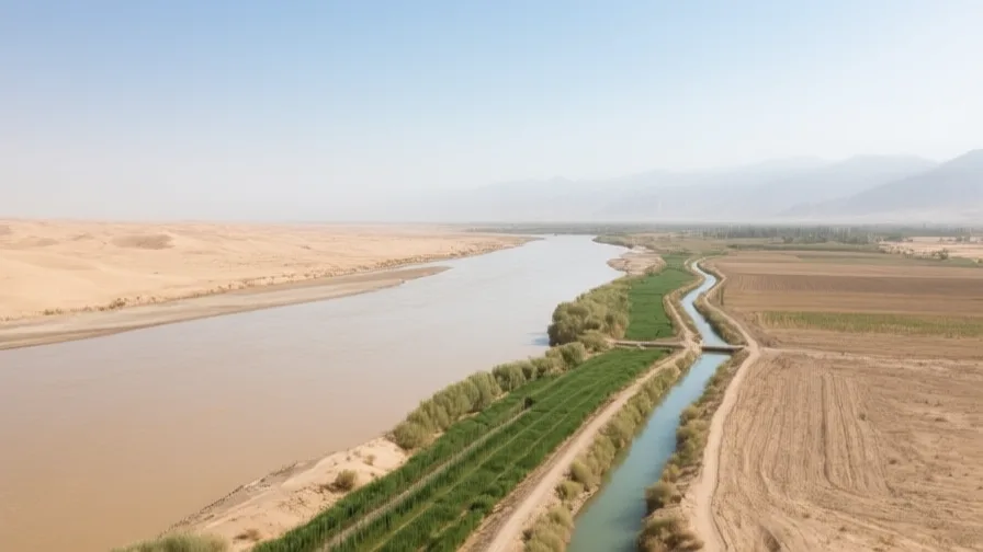
 The Amu Darya · AI landscape illustration · Artistic impression
Natural feature · Central Asia
The Amu Darya
Also known as Oxus, Jayhun, Āmū Daryā
Central Asia's largest river by volume, historically the Oxus, and one of the two rivers diverted away from the Aral Sea.
Saved in this browser — no account needed. Sign in later and it comes with you.
Where it is
The Amu Darya rises in the Pamirs and runs some 2,400 kilometres north-west through Tajikistan, along the Afghan border, and across Turkmenistan and Uzbekistan toward what is left of the Aral Sea. It is Central Asia's largest river by volume and it crosses one of its driest regions, so almost everything alongside it is there because of it. Below its confluences it gains no significant tributaries at all: it runs for well over a thousand kilometres through desert, losing water the whole way.
The land and water around it
The Pamir headwatersmountains
Glacier and snowmelt in the Pamirs supply most of the flow. That makes the river's water a stored asset released in summer, and it makes it sensitive to what happens to the glaciers.
The Karakumdesert
The desert the river skirts and is drawn into. The Karakum Canal, one of the largest irrigation canals in the world, takes water west across it — much of it historically lost to seepage and evaporation before arriving.
The river's delta at the southern Aral. For much of the late twentieth century almost no water reached it at all, and the delta lakes and reedbeds that fishing and herding depended on largely went.
Its history, in short
As the Oxus, this river was the boundary the Greeks reached and the frontier between settled Transoxiana and the steppe. Along it stood Khorezm, Balkh, Termez and Kunya-Urgench, and the irrigated oases it fed supported cities for millennia. The Mongol invasion of the thirteenth century destroyed both the cities and, critically, the canal systems, and the region did not recover its former population for centuries. In the nineteenth century the river became the line between Russian and British spheres, and in the twentieth the Soviet Union expanded irrigation from it on an enormous scale for cotton — the decision that emptied the Aral Sea.
Timeline
Dates are shown on a timeline rather than as changing shapes on the map. The globe draws modern boundaries only, and tinting a modern outline to stand for a historical one would state something we cannot source.
Classical world
329 BCE
Alexander crosses the Oxus
The Macedonian army crosses the river into Sogdiana. The Oxus stayed in European geography afterwards as the edge of the known world, which is a good example of a frontier being defined by whoever wrote about it.
Well attestedEncyclopædia Britannica
Post-classical world
1220–21
The Mongols and the canals
Khorezm is invaded and its cities destroyed. What did not recover was the irrigation network: canals that took generations to build and constant labour to maintain were cut, and the land they watered went out of cultivation.
Well attestedUNESCO World Heritage Centre
Industrial & imperial
1873
Khiva becomes a protectorate
The Russian Empire subordinates the khanate of Khiva on the lower river. The Amu Darya becomes an imperial administrative line as well as a hydrological one.
Well attestedUNESCO World Heritage Centre
Contemporary
1954–1988
The Karakum Canal
A canal is dug westward from the river across Turkmenistan, eventually running over 1,300 kilometres. It made cotton and settlement possible in the desert and took a very large share of the river's flow to do it.
Well attestedEncyclopædia Britannica1960s onward
The Aral empties
Diversion from the Amu Darya and the Syr Darya for cotton irrigation causes the Aral Sea to shrink by most of its area and the great majority of its volume, splitting into separate bodies. The consequence was understood by planners in advance and accepted as the price of cotton.
Well attestedNASA Earth Observatory1991
One river, five states
The Soviet collapse turns an internal allocation problem into an international one. Upstream Tajikistan and Afghanistan hold the water; downstream Turkmenistan and Uzbekistan hold the irrigated cotton land, and the arrangements between them have been renegotiated ever since.
Well attestedEncyclopædia Britannica2022 onward
The Qosh Tepa canal
Afghanistan begins a large canal to take water from the river for irrigation in the north. Downstream states have objected; Afghanistan was not party to the Soviet-era allocation arrangements, which is precisely the point of dispute.
Approximate dateEncyclopædia BritannicaAfghan, Uzbek and Turkmen official positions on the canal's legality and its likely abstraction differ substantially, and independent measurement of the works is limited.
Places that carry meaning
Kunya-Urgench10th–14th centuries
The Khorezmian capital on the lower river, destroyed by the Mongols and again by Timur, and never rebuilt on the same scale. What stands are minarets and mausolea in open ground.
Itchan Kala, KhivaLargely 18th–19th centuries
The walled inner town of the last khanate on the river, and the most completely preserved. It was also a major slave market until Russian annexation, which the architecture does not advertise.
The Aral seabedLate 20th century onward
Exposed lakebed, saline and dusty, with salt and agricultural chemicals lifted off it by wind. The dust is a public health problem across a wide area downwind.
Languages here
Places are usually multilingual. This lists what is actually spoken, not one language per border.
UzbekTurkic family
The language of the lower river's most populous state.
Written in Arabic script, then Latin, then Cyrillic, and since 1993 officially returning to Latin — four script changes in a century, each one making the previous generation's printed record harder to read.
TurkmenTurkic family
Spoken along the river's western course.
Also moved between scripts through the twentieth century. Closely related to Azerbaijani and Turkish, and mutually intelligible with them to a degree that surprises people who expect national borders to mark linguistic ones.
TajikIranian family
Spoken in the headwaters.
A variety of Persian written in Cyrillic — the same language as Iranian and Afghan Persian, separated mainly by script and by a century of separate standardisation.
KarakalpakTurkic family
Spoken in the delta region.
Closer to Kazakh than to Uzbek despite Karakalpakstan being part of Uzbekistan. Its speakers were among the people most directly harmed by the loss of the sea.
Learn the language here
Check yourself
What is unusual about the Amu Darya's lower course?
It gains no significant tributaries for over a thousand kilometres
It crosses desert losing water the whole way, which is why abstraction upstream has such a large downstream effect.
Was the Aral Sea's shrinkage foreseen?
Yes — planners anticipated it and accepted it as the price of cotton
This was a deliberate trade-off, not an accident, which changes what kind of lesson it is.
Worth arguing about
- A sea was traded for a crop, knowingly. Who should have been able to refuse that trade?
- Upstream holds the water, downstream holds the fields, and the agreement they inherited was written by a state that no longer exists. How should that be settled?
What we have not established
These are open questions, listed rather than filled in. We would rather show a gap than a plausible guess.
How much water will the Qosh Tepa canal actually take?
Published figures come from parties to the dispute and the works are still being built. Independent measurement of abstraction is not currently available, so we record the disagreement rather than a volume.
Sources
- Britannica · Amu DaryaEncyclopædia Britannica · encyclopedia · checked 2026-09-08
- NASA Earth Observatory · World of Change: Shrinking Aral SeaNASA Earth Observatory · government · checked 2026-09-08
- UNESCO · Itchan KalaUNESCO World Heritage Centre · intergovernmental · checked 2026-09-08
- UNESCO · Kunya-UrgenchUNESCO World Heritage Centre · intergovernmental · checked 2026-09-08
Reviewed by Globe Quest editorial on 2026-09-08.
Related places
Themes: Rivers & cities, Water & environment, Trade & exchange, Empires & independence