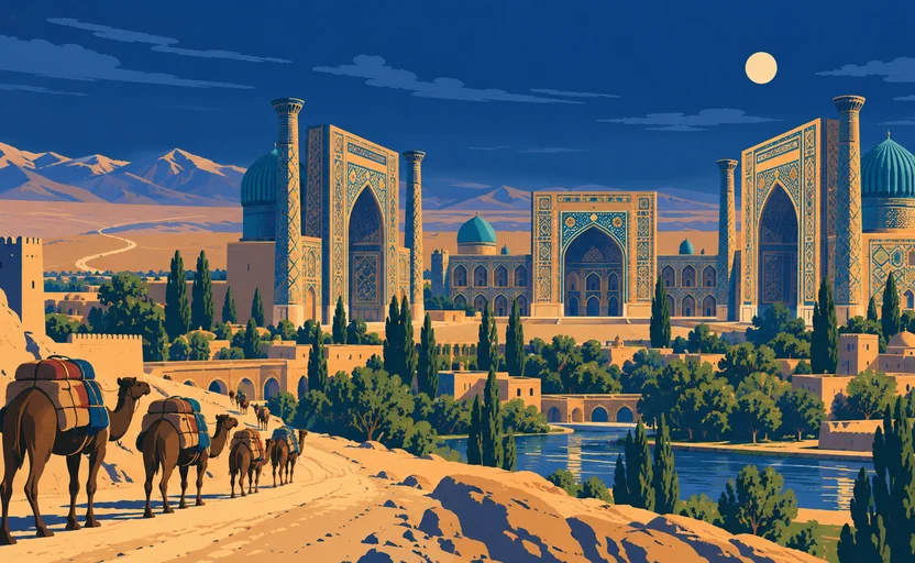
 Samarkand · AI illustration, not a photograph
Historical place · Central Asia
Samarkand
Also known as Samarqand, Marakanda, Afrasiab
An oasis city on the Zeravshan, occupied for well over two thousand years and a major node on the overland routes across Asia.
Saved in this browser — no account needed. Sign in later and it comes with you.
Read its story
Where it is
Samarkand sits in the Zeravshan valley in eastern Uzbekistan, in an oasis belt between the Pamir-Alay mountains and the Kyzylkum desert. The Zeravshan is meltwater: it comes out of the mountains, waters Samarkand and, downstream, Bukhara, and then disappears into the desert without reaching a sea. That is the whole basis of the city. An overland route across Central Asia is not a line on a map but a chain of places where animals and people can be watered, and the river decides where the chain can go.
The land and water around it
The Zeravshanriver
Meltwater from the Pamir-Alay running west into the Kyzylkum. It supports the Samarkand and Bukhara oases and then ends in the desert — a river that never reaches the sea, and the reason cities exist here at all.
The Kyzylkumdesert
The desert west and north of the oasis belt. Crossing it is what made the oases valuable: a caravan needs water at intervals, and whoever supplies it sets the terms.
Its history, in short
The mound of Afrasiab north of the modern city is the older settlement, occupied for centuries before Alexander's army reached the place Greek writers called Marakanda in 329 BCE. Samarkand was a node on the overland routes across Asia — a relay system rather than a highway, in which goods changed hands many times and very few people travelled the whole distance. It was destroyed by Mongol armies in the thirteenth century, rebuilt, and in the late fourteenth became Timur's capital, which is when most of the buildings people picture were made. It has been Persian-speaking, Turkic-speaking, Soviet and Uzbek, and a large share of its own population speaks a language that is not the state's.
Timeline
Dates are shown on a timeline rather than as changing shapes on the map. The globe draws modern boundaries only, and tinting a modern outline to stand for a historical one would state something we cannot source.
Classical world
c. 7th century BCE onward
Afrasiab
Settlement on the mound north of the modern city, several centuries before any Greek arrival. Dating rests on excavation and is given as a range.
Approximate dateUNESCO World Heritage Centre329 BCE
Alexander reaches Marakanda
Alexander's army arrives at the city Greek writers call Marakanda. The city was already old; the Greek name is the first written record of it that survives in a European language, which is a different thing.
Well attestedUNESCO World Heritage Centre
Post-classical world
8th century
Papermaking travels west
Paper manufacture is transmitted westward through Central Asia in this period, with Samarkand among the earliest western centres of it. The traditional account attributing the transfer to prisoners taken at the Talas River in 751 is a much later story and is not securely evidenced.
The Talas-prisoners account comes from later medieval writers rather than contemporary records. Historians of technology accept the westward transmission of papermaking through the region and treat the specific origin story with caution.
1220
Mongol destruction
Mongol armies take and destroy the city. It is subsequently rebuilt on a site somewhat south of Afrasiab, which is why the old mound is now archaeology and the living city is beside it.
Well attestedUNESCO World Heritage Centre1370–1405
Timur's capital
Timur makes Samarkand his capital and builds monumentally, using craftsmen deported from conquered cities. The architecture people travel to see and the violence that assembled its makers are the same programme.
Well attestedUNESCO World Heritage Centre1420s
The Ulugh Beg observatory
Ulugh Beg builds an observatory with a very large meridian arc and compiles a star catalogue of enduring accuracy for pre-telescopic astronomy. He was assassinated in 1449 and the observatory was destroyed soon after.
Well attestedUNESCO World Heritage Centre
Contemporary
2001
Inscribed as World Heritage
Samarkand is inscribed as 'Crossroad of Cultures'. Subsequent restoration work in the city has drawn criticism from conservation bodies for its approach to authenticity.
Well attestedUNESCO World Heritage Centre
Places that carry meaning
The Registan15th–17th centuries
Three madrasas facing a public square, built across two centuries. The Sher-Dor madrasa's facade carries large figurative lion-and-sun images, which is worth noticing against the assumption that Islamic architecture is uniformly aniconic.
Shah-i-Zinda11th–19th centuries
A street of mausolea built up over eight centuries, with tilework spanning the whole period. It reads as one place and is in fact a very long accumulation.
Afrasiab7th century BCE – 13th century CE
The mound of the pre-Mongol city, now an archaeological site with a museum. Its seventh-century CE wall paintings show envoys from several polities and are among the best evidence for the region's connections.
Languages here
Places are usually multilingual. This lists what is actually spoken, not one language per border.
TajikIranian family
Spoken by a large part of Samarkand's own population.
A variety of Persian. Samarkand and Bukhara are historically Persian-speaking cities inside a Turkic-majority state, which is exactly the situation a country-level language label erases.
UzbekTurkic family
The state language of Uzbekistan.
Written in Arabic script, then Latin, then Cyrillic under Soviet rule, and officially back to Latin since 1993 — three alphabet changes in a century, each of which put the previous generation's printed matter out of easy reach.
RussianSlavic family
Still widely used, especially in administration, higher education and between nationalities.
A legacy of Soviet rule rather than of the trade routes, and declining among younger speakers.
Learn the language here
- 1Understand which languages are spoken hereSamarkand is multilingual. Start with which languages are used, by whom, and for what — the phrase list only covers one of them.Written by Globe Quest
- 2Read why the language is what it isThe quest for this place covers how its languages got here and who speaks them.Written by Globe Quest
Check yourself
Why does the Zeravshan explain Samarkand?
It waters an oasis in an arid corridor, so a caravan route can pass through
A route across dry country is a chain of watering points. The river decides where the chain can go — the goods travelled by camel, not by boat.
What is the most accurate description of the overland Asia routes?
A shifting network of segments with goods changing hands repeatedly
Relay trade across many segments, which is why the heritage listing covers a corridor of sites rather than a road.
Worth arguing about
- Which language do you assume when you think of a country? Find a city where the assumption fails.
- Timur's monuments were built by craftsmen deported from cities he destroyed. How should a site present that?
What we have not established
These are open questions, listed rather than filled in. We would rather show a gap than a plausible guess.
What proportion of Samarkand's population speaks Tajik as a first language?
Uzbek census categories record nationality rather than language, and independent estimates vary widely and are politically contested. We state that the share is large without quoting a figure.
Sources
- UNESCO · Samarkand – Crossroad of CulturesUNESCO World Heritage Centre · intergovernmental · checked 2026-09-08
- UNESCO · Silk Roads: the Routes Network of Chang'an-Tianshan CorridorUNESCO World Heritage Centre · intergovernmental · checked 2026-09-08
Reviewed by Globe Quest editorial on 2026-09-08.
Related places
Themes: Trade & exchange, Languages & contact, Empires & independence, Religion & pilgrimage