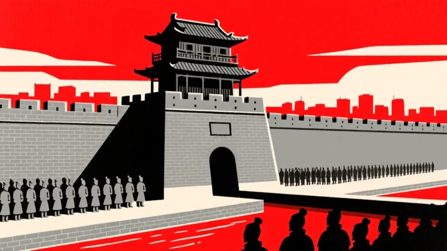
 Xi'an · AI illustration, not a photograph
Historical place · East Asia
Xi'an
Also known as Chang'an, 西安, 長安
A city in the Wei valley that served as an imperial capital under several Chinese dynasties and as the eastern end of the overland routes west.
Saved in this browser — no account needed. Sign in later and it comes with you.
Read its story
Where it is
Xi'an sits in the Wei river valley in the Guanzhong basin, ringed by mountains and reached through a small number of passes. That combination — good loess farmland inside a defensible bowl, with the routes west opening from its far end — is why so many dynasties put their capital here. As Chang'an it was the eastern anchor of the overland routes across Asia, and at its Tang height it was laid out on a grid of walled wards on a scale nothing in Europe then approached.
The land and water around it
The Guanzhong basinbasin
A fertile bowl on the Wei, enclosed by mountains and entered through passes. Defensible enough to hold a capital and productive enough to feed one, which is a rarer combination than it sounds.
The Wei riverriver
A major tributary of the Yellow River, and the valley's axis. Successive capitals sat on or near it, shifting position as channels and canals changed.
The loess plateauplateau
Wind-deposited silt north and west of the city — easy to work, easy to erode, and the reason the Yellow River carries the sediment load it does.
Its history, in short
The valley holds capitals from the Western Zhou onward. The First Qin Emperor unified the warring states from here in 221 BCE and was buried a short way east under a mound whose surrounding pits held a life-size army. Han and then Tang Chang'an made the city a terminus for merchants, monks, envoys and musicians from across Asia; Nestorian Christians, Zoroastrians, Manichaeans and Muslims all had communities in it. After the Tang collapsed the capital moved east for good and the city became a provincial one. In 1974 farmers digging a well found the terracotta figures, and the city's modern identity was set by what was under it rather than what was on it.
Timeline
Dates are shown on a timeline rather than as changing shapes on the map. The globe draws modern boundaries only, and tinting a modern outline to stand for a historical one would state something we cannot source.
Classical world
221 BCE
Qin unifies the states
The Qin state completes its conquest of the other warring states and imposes a single script, currency and axle width. The empire lasted about fifteen years; the administrative model lasted two millennia.
Well attestedEncyclopædia Britannicac. 210 BCE
The mausoleum
The First Emperor is buried under a mound east of the city. Ancient accounts describe a subterranean palace with rivers of mercury; the central tomb has not been excavated, and elevated mercury readings in the soil have been reported without settling what is inside.
Approximate dateUNESCO World Heritage Centre
Post-classical world
618–907
Tang Chang'an
The city becomes the capital of the Tang and one of the largest in the world, laid out as a walled grid of wards with markets that opened and closed by drum. Foreign merchants, clergy and envoys lived in it in numbers.
781
The Nestorian stele
A stone is erected recording the presence of the Church of the East in China, in Chinese and Syriac. It is direct evidence that a Christian community was established here more than a thousand years before European missions.
Well attestedEncyclopædia Britannica904
The capital moves
Chang'an is sacked and dismantled during the Tang collapse, and the imperial capital never returns. The city continues as a regional centre at a fraction of its former size.
Well attestedEncyclopædia Britannica
Contemporary
March 1974
The well
Farmers sinking a well east of the city strike fired clay. Excavation reveals pits holding thousands of life-size figures, each with individual facial modelling, arranged in formation.
Well attestedUNESCO World Heritage Centre2014
Inscribed as a corridor, not a site
The Chang'an–Tianshan corridor is inscribed as a single transnational property spanning China, Kazakhstan and Kyrgyzstan — a route listed as heritage rather than a monument.
Well attestedUNESCO World Heritage Centre
Places that carry meaning
The terracotta armyc. 210 BCE
Pits of infantry, archers, chariots and horses guarding the approach to the mound. They were painted; most of the pigment did not survive contact with air after excavation, which is one reason the central tomb is left alone.
The Great MosqueFounded in the Tang period; standing buildings largely Ming
A mosque built to a Chinese courtyard plan, with a pagoda-form minaret. It belongs to the Hui community, whose presence in the city goes back to the overland trade.
The Ming walls14th century
The circuit still standing enclosed the much-reduced Ming city, not Tang Chang'an, which was several times larger. The walls are a good lesson in how a city's most visible monument can misrepresent its scale.
Languages here
Places are usually multilingual. This lists what is actually spoken, not one language per border.
Mandarin ChineseSinitic family
The language of the city, in its Central Plains form.
The local speech belongs to the Zhongyuan Mandarin group and differs audibly from the Beijing-based standard. Tang poetry was composed in a much earlier stage of Chinese, and is reconstructed rather than pronounced as written today.
SogdianIranian family
A trade language of the overland routes, spoken by resident merchant communities.
Sogdian traders from the region around Samarkand ran much of the commerce along the route and left letters, contracts and religious texts. The language is long extinct; Yaghnobi in Tajikistan descends from a related variety.
Learn the language here
- 1Understand which languages are spoken hereXi'an is multilingual. Start with which languages are used, by whom, and for what — the phrase list only covers one of them.Written by Globe Quest
- 2Read why the language is what it isThe quest for this place covers how its languages got here and who speaks them.Written by Globe Quest
Check yourself
What was inscribed as World Heritage in 2014?
A transnational route corridor spanning three countries
The Chang'an–Tianshan corridor lists a route across China, Kazakhstan and Kyrgyzstan rather than a single monument.
What do the standing city walls enclose?
The much smaller Ming city
Tang Chang'an was several times larger. The most visible monument describes a later, smaller city.
Worth arguing about
- The central tomb is deliberately not excavated. When is not digging the right archaeological decision?
- A route was listed as heritage instead of a building. What else is better understood as a corridor than a place?
What we have not established
These are open questions, listed rather than filled in. We would rather show a gap than a plausible guess.
How large was Tang Chang'an's population?
Figures of around a million are widely repeated and rest on registered-household estimates that counted differently inside and outside the walls. We describe the city's scale rather than assert a number we cannot source to a stated method.
Sources
- UNESCO · Mausoleum of the First Qin EmperorUNESCO World Heritage Centre · intergovernmental · checked 2026-09-08
- UNESCO · Silk Roads: the Routes Network of Chang'an-Tianshan CorridorUNESCO World Heritage Centre · intergovernmental · checked 2026-09-08
- Britannica · Xi'anEncyclopædia Britannica · encyclopedia · checked 2026-09-08
Reviewed by Globe Quest editorial on 2026-09-08.
Related places
Themes: Trade & exchange, Empires & independence, How cities work, Religion & pilgrimage