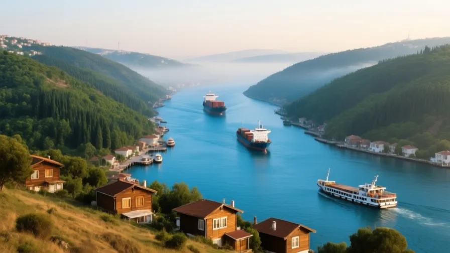
 The Bosphorus · AI landscape illustration · Artistic impression
Natural feature · Europe
The Bosphorus
Also known as Boğaziçi, Istanbul Strait, Thracian Bosporus
The strait joining the Black Sea to the Sea of Marmara, and the water Istanbul is built along both sides of.
Saved in this browser — no account needed. Sign in later and it comes with you.
Where it is
The Bosphorus is a 31-kilometre strait joining the Black Sea to the Sea of Marmara, and through the Dardanelles to the Aegean and Mediterranean. At its narrowest it is under a kilometre wide. Istanbul is built along both banks, so the strait runs through a city of well over fifteen million people rather than past it — one of very few places on Earth where a major international shipping lane is also a commuter waterway.
The land and water around it
The Golden Hornharbour
A deep inlet running north-west off the strait, sheltered from both Black Sea storms and Marmara swell. It gave the historic peninsula a natural harbour that could be closed with a chain, and it is the second half of why this site was worth holding.
The Sea of Marmarasea
An inland sea between the Bosphorus and the Dardanelles, effectively an antechamber between the Black Sea and the Aegean. Its existence is why the passage is two straits in series rather than one.
Its history, in short
The strait has been strategically decisive for as long as there have been states around it, because it is the only sea route between the Black Sea and the Mediterranean and it is narrow enough to control from the shore. Greek colonists founded Byzantium on the peninsula beside it; Constantine made that city an imperial capital; the Ottomans took it in 1453 and held both shores. In the twentieth century the strait's legal status was settled by treaty rather than by fortification, which is a different kind of control over the same water.
Timeline
Dates are shown on a timeline rather than as changing shapes on the map. The globe draws modern boundaries only, and tinting a modern outline to stand for a historical one would state something we cannot source.
Classical world
c. 660 BCE
Byzantium founded
Greek settlers, traditionally from Megara, establish a colony on the peninsula at the strait's southern end. The traditional date comes from later Greek sources and is approximate.
Approximate dateUNESCO World Heritage Centre330 CE
The city becomes an imperial capital
Constantine dedicates the rebuilt city as a new imperial capital, which fixes the strait at the centre of Roman and later Eastern Roman administration for over a millennium.
Well attestedUNESCO World Heritage Centre
Early modern & oceanic
1453
Ottoman conquest
Mehmed II takes the city after a siege in which large gunpowder artillery is used against fortifications that had held for a thousand years. Both shores of the strait come under one authority.
Well attestedUNESCO World Heritage Centre
Industrial & imperial
1936
The Montreux Convention
A treaty signed at Montreux returns control of the straits to Türkiye and sets the rules that still govern passage, including limits on warships of non-Black Sea states. Control of the strait becomes a legal instrument rather than a military one.
Well attestedUNESCO World Heritage Centre
Contemporary
1973
The first road bridge opens
The first suspension bridge across the Bosphorus opens, followed by further bridges and, in 2013, a rail tunnel beneath the strait. For the first time the water is routinely crossed without a boat.
Well attestedUNESCO World Heritage Centre2025
Forty thousand ships a year
Türkiye's transport ministry records 40,172 vessel transits of the Istanbul Strait in 2025 and 44,468 of the Çanakkale Strait — 84,640 across the Turkish Straits together — carrying 422.8 million tonnes of cargo through the Istanbul Strait, of which 203.7 million tonnes were classed as dangerous. Tankers were roughly a quarter of transits.
Places that carry meaning
Rumeli Hisarı1452
A fortress built on the European bank at the strait's narrowest point in the months before the 1453 siege, positioned to cut shipping to the city. Its purpose was to close the water, which is what the whole strait is about.
Hagia Sophia537 CE onward
The great domed building on the peninsula beside the strait, in use as cathedral, mosque and museum at different times. Visible from the water, and the single most-argued building in the city.
Languages here
Places are usually multilingual. This lists what is actually spoken, not one language per border.
TurkishTurkic family
The official and everyday language of the city on both banks.
Turkish has been the dominant language of the city since the Ottoman period, written in Arabic script until the 1928 alphabet reform and in Latin script since.
GreekHellenic family
Historic community language, now spoken by a very small remaining population.
Greek was a major language of the city for most of its history. The Greek Orthodox Ecumenical Patriarchate remains in the Fener district, but the community itself is now small, following the population exchange of 1923 and later departures.
LadinoRomance family
Historic community language of Sephardic Jews in the city.
A Judaeo-Spanish language brought by Jews expelled from Iberia in 1492 and settled in Ottoman cities. Still spoken by a small and mostly elderly population in Istanbul.
Learn the language here
Check yourself
Which two bodies of water does the Bosphorus connect?
The Black Sea and the Sea of Marmara
The Bosphorus joins the Black Sea to the Sea of Marmara; the Dardanelles then joins Marmara to the Aegean.
What does the Montreux Convention govern?
Passage of shipping, including warships, through the Turkish straits
The 1936 convention sets the rules for transit through the straits and remains in force.
Worth arguing about
- A shipping lane that runs through the middle of a city of millions: who should bear the risk of an accident?
- Control of the strait shifted from fortresses to a treaty. Is legal control more or less stable than physical control?
What we have not established
These are open questions, listed rather than filled in. We would rather show a gap than a plausible guess.
What share of the strait's traffic is grain?
Transit and dangerous-cargo totals are published by Türkiye's transport ministry and cited above, and the US Energy Information Administration publishes oil flows. Neither, nor UNCTAD's maritime chokepoints reporting, gives a grain share for the Turkish Straits. Widely repeated grain percentages trace to trade press rather than to a statistical authority, so none is quoted here.
Why do vessel-count figures for the Turkish Straits disagree?
The US EIA states 'more than 45,000 vessels' transited the straits in 2024, while Türkiye's own ministry records 87,212 across both straits that year. The two are probably counting different things — one strait versus both, or transits versus movements — but neither publishes a reconciliation, so we cite the Turkish series and flag the discrepancy rather than choosing.
Sources
- UNESCO · Historic Areas of IstanbulUNESCO World Heritage Centre · intergovernmental · checked 2026-09-07
- Türk Boğazları Gemi Geçiş İstatistikleri (Turkish Straits vessel transit statistics)T.C. Ulaştırma ve Altyapı Bakanlığı (Türkiye, Ministry of Transport and Infrastructure) · statistical · checked 2026-09-07
Reviewed by Globe Quest editorial on 2026-09-07.
Related places
Themes: Seas & navigation, Trade & exchange, Empires & independence