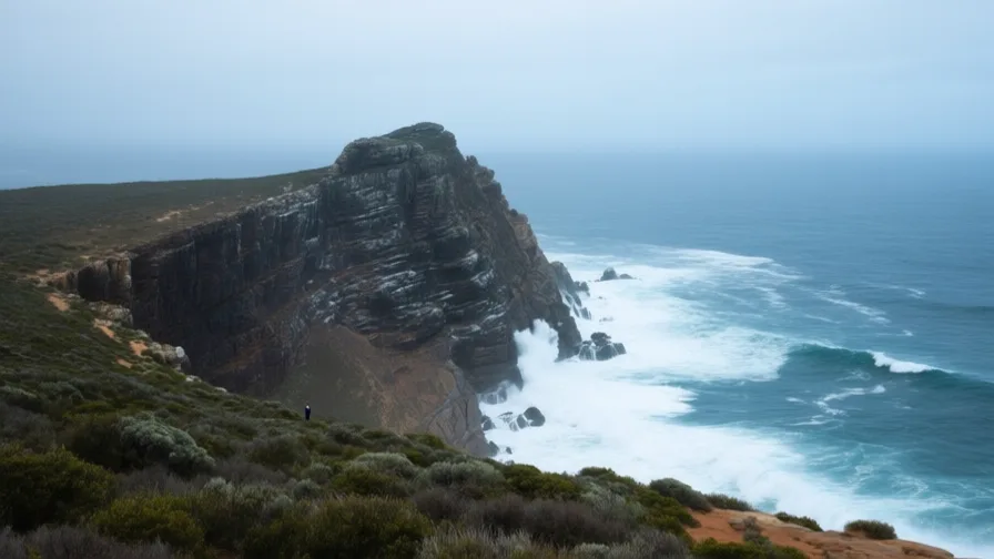
 Cape of Good Hope · AI landscape illustration · Artistic impression
Natural feature · Africa
Cape of Good Hope
Also known as Kaap die Goeie Hoop, Cabo da Boa Esperança
A rocky headland on the Cape Peninsula, long treated as the turning point on the sea route between the Atlantic and Indian Oceans.
Saved in this browser — no account needed. Sign in later and it comes with you.
Where it is
The Cape of Good Hope is a rocky headland near the southern end of the Cape Peninsula in South Africa. It is not the southernmost point of Africa — that is Cape Agulhas, about 150 kilometres to the south-east, which is also the formal dividing line between the Atlantic and Indian Oceans. The Cape's importance is navigational rather than geographical: for a ship coming down the Atlantic it is the point at which the coast turns east and the course changes, and the seas there are notoriously rough where currents and prevailing westerlies meet.
The land and water around it
Table Mountainmountains
The flat-topped massif above Table Bay, a landmark visible far out to sea and the reason the bay is identifiable from a distance.
The Cape Peninsulaheadland
A narrow mountainous spur running south from the mainland, with Table Bay on one side and False Bay on the other. The Cape of Good Hope sits near its tip.
The Cape Floral Regionforest
Fynbos shrubland of extraordinary plant diversity, much of it found nowhere else, occupying a very small area. Fire is part of its ecology rather than a threat to it.
Its history, in short
Bartolomeu Dias rounded the Cape in 1488, and Vasco da Gama passed it on the way to India ten years later, opening a sea route between Europe and the Indian Ocean that did not pass through the Mediterranean or the Levant. For the next three and a half centuries every ship on that route turned this corner. That single fact produced the settlement at Table Bay in 1652, the colony that grew from it, and the country that grew from the colony. The Suez Canal opened in 1869 and took much of the traffic; the Cape route remains in use for the largest vessels and whenever Suez is disrupted.
Timeline
Dates are shown on a timeline rather than as changing shapes on the map. The globe draws modern boundaries only, and tinting a modern outline to stand for a historical one would state something we cannot source.
Early modern & oceanic
1488
Dias rounds the Cape
A Portuguese expedition passes the southern tip of Africa and confirms that the Atlantic and Indian Oceans connect. Portuguese naming of the headland reflected the hope it created rather than the conditions there.
Well attestedUNESCO World Heritage Centre1498
The route reaches India
Vasco da Gama arrives in India by sea, and the Cape becomes a fixed waypoint on the busiest long-distance route in the world.
Well attestedUNESCO World Heritage Centre1652
A refreshment station at Table Bay
The Dutch East India Company establishes a supply post for passing ships. The stated intention is not a colony; farms, land seizure from Khoikhoi pastoralists and imported enslaved labour follow within years.
Well attestedUNESCO World Heritage Centre
Industrial & imperial
1869
Suez opens
The Suez Canal gives Europe–Asia shipping a route that skips Africa entirely. Cape traffic falls sharply, and the region's economy reorients toward minerals found inland.
Well attestedUNESCO World Heritage Centre
Contemporary
2004
The Cape Floral Region inscribed
The fynbos region is inscribed as World Heritage for its plant diversity — one of the smallest and richest floral kingdoms recognised anywhere.
Well attestedUNESCO World Heritage Centre
Places that carry meaning
Cape AgulhasGeographic
The actual southern tip of Africa and the formal Atlantic–Indian boundary. The Cape of Good Hope is more famous and less southerly, which is worth noticing about how places become famous.
Robben Island17th century onward
In Table Bay, in plain view of the city, used as a place of banishment for centuries and as a maximum-security political prison under apartheid.
Languages here
Places are usually multilingual. This lists what is actually spoken, not one language per border.
AfrikaansGermanic family
Widely spoken across the Western Cape.
Developed at the Cape from Dutch in contact with Khoikhoi, Malay and the languages of enslaved people. Most first-language speakers today are coloured South Africans, not white — a fact the language's twentieth-century political history obscured.
isiXhosaBantu family
A major language of the Eastern and Western Cape.
One of South Africa's most widely spoken languages, with click consonants borrowed through long contact with Khoisan languages.
Khoisan languagesKhoe-Kwadi and others family
The languages of the Cape's earliest recorded inhabitants; most are extinct or severely endangered.
The languages spoken at the Cape in 1652 are largely gone. Nǀuu has a handful of speakers; revitalisation efforts exist and the loss is nearly complete.
Learn the language here
Check yourself
Is the Cape of Good Hope the southern tip of Africa?
No — Cape Agulhas is, about 150 km south-east
The Cape's significance is navigational: it is where the coast turns east for a ship coming down the Atlantic.
What did the opening of Suez in 1869 do to the Cape route?
Took much of the Europe–Asia traffic, though the Cape route is still used
The largest vessels and any Suez disruption still send traffic around the Cape.
Worth arguing about
- The Cape mattered because of where ships had to turn, not because of anything on it. How many places near you exist for a similar reason?
- Afrikaans was made at the Cape by Dutch, Khoikhoi, Malay and enslaved people together. Who gets remembered as a language's authors?
What we have not established
These are open questions, listed rather than filled in. We would rather show a gap than a plausible guess.
How much shipping still rounds the Cape rather than using Suez?
The share moves sharply with Red Sea security and with vessel size limits at Suez, so any figure is a snapshot rather than a rate. We have not fixed a published series we could cite and re-check on a schedule.
Sources
- UNESCO · Cape Floral Region Protected AreasUNESCO World Heritage Centre · intergovernmental · checked 2026-09-08
- UNESCO · Robben IslandUNESCO World Heritage Centre · intergovernmental · checked 2026-09-08
- UNESCO · Monastery of the Hieronymites and Tower of Belém in LisbonUNESCO World Heritage Centre · intergovernmental · checked 2026-09-08
Reviewed by Globe Quest editorial on 2026-09-08.
Related places
Themes: Seas & navigation, Trade & exchange, Empires & independence