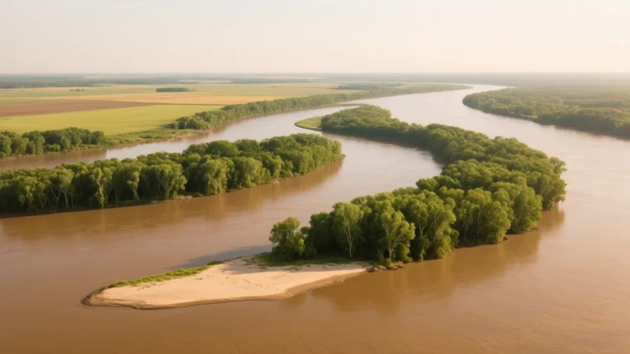
 The Mississippi · AI landscape illustration · Artistic impression
Natural feature · North America
The Mississippi
Also known as Misi-ziibi, Meschacebé
The principal river of North America's interior, draining a basin that reaches from the Rockies to the Appalachians.
Saved in this browser — no account needed. Sign in later and it comes with you.
Where it is
The Mississippi drains most of the interior of North America — a basin reaching from the Rocky Mountains to the Appalachians, covering a large share of the continental United States and a slice of Canada. Its major tributaries are themselves continental rivers: the Missouri from the west, the Ohio from the east. Below their confluences the river carries an enormous sediment load south across a wide alluvial valley to a delta on the Gulf of Mexico.
The land and water around it
The wetlands at the river's mouth, built over millennia by sediment the river spread across them during floods. Levees now send that sediment down the channel and off the continental shelf instead, so the marsh compacts and erodes without being replaced.
The Atchafalayariver
A shorter, steeper route to the Gulf that the Mississippi has been trying to switch into for decades — the ordinary behaviour of a delta river seeking the steepest path. A control structure at Old River holds the split at a fixed ratio, which is a permanent commitment rather than a solved problem.
The alluvial valleybasin
A broad, flat floodplain of deep river-laid soil through the lower basin, agriculturally rich for the same reason it floods.
Its history, in short
Before railways, a river basin this size was a transport system, and the settlements at its confluences and its mouth captured the traffic. That is why Cahokia stands near the Mississippi–Missouri junction and New Orleans near the mouth. The modern history is one of control: levees to stop the river flooding, revetments to stop it moving, and a structure built to stop it changing course altogether. Each of those decisions worked, and each transferred a cost — chiefly the loss of the coastal wetland the river used to rebuild.
Timeline
Dates are shown on a timeline rather than as changing shapes on the map. The globe draws modern boundaries only, and tinting a modern outline to stand for a historical one would state something we cannot source.
Post-classical world
c. 1050–1350
Cahokia
A large settlement of earthen mounds near the Mississippi–Missouri confluence, at its height the largest urban site north of Mesoamerica. It is abandoned before European contact, for reasons still debated.
Approximate dateUNESCO World Heritage Centre
Early modern & oceanic
1718
New Orleans founded
A French settlement is placed on a crescent of the river at a short portage to Lake Pontchartrain — a route already in use by Indigenous peoples of the region. The site is chosen for connection, not for ground.
Well attestedU.S. National Park Service
Industrial & imperial
1927
The Great Mississippi Flood
A catastrophic flood inundates a vast area of the lower valley, displaces hundreds of thousands of people — disproportionately Black communities, some held in labour camps on the levees — and drives a federal flood-control programme that shapes the river for the rest of the century.
Well attestedU.S. Geological Survey
Contemporary
1963
The Old River Control Structure
A structure is completed to hold the division of flow between the Mississippi and the Atchafalaya at a fixed proportion, preventing the river from switching course. It has to keep working indefinitely.
Well attestedU.S. Geological Survey2005
Hurricane Katrina and the levee failures
Storm surge causes multiple failures of levees and floodwalls around New Orleans. Subsequent investigations characterised it as an engineering and institutional failure rather than simply an unusually large storm.
Well attestedU.S. Geological Survey
Places that carry meaning
Cahokiac. 1050–1350
Earthen mounds on the floodplain near the confluence, including one of the largest earthworks in the Americas. Its scale is evidence of organised labour and long-distance exchange along the river system.
New Orleans1718 onward
Near the mouth, on ground that is mostly at or below sea level, protected by levees and pumps. The city's existence is a continuing decision rather than a settled fact.
Languages here
Places are usually multilingual. This lists what is actually spoken, not one language per border.
EnglishGermanic family
The dominant language throughout the basin today.
Regional varieties along the lower river, including African American English, carry their own long histories and are frequently mischaracterised as departures from a standard rather than as systems in their own right.
Louisiana French and Louisiana CreoleRomance / French-lexifier creole family
Historic community languages of the lower valley, now spoken by relatively few.
Two distinct things often conflated. Both declined sharply through twentieth-century schooling policy, and both are the subject of current revitalisation effort.
Indigenous languages of the basinAlgonquian, Muskogean and others family
Including Ojibwe upstream and Choctaw, Chickasaw and others in the lower valley.
The river's own name descends from an Algonquian term. Many basin languages have few first-language speakers today, and several nations run active reclamation programmes.
Learn the language here
Check yourself
How do levees contribute to coastal land loss?
They stop floods spreading sediment onto the marsh, so it compacts and erodes unreplaced
A delta stays above water because floods resupply it. Confine the flood and the sediment goes offshore instead.
What is the Old River Control Structure for?
Holding the flow split with the Atchafalaya so the river cannot change course
The river has been trying to switch to the shorter Atchafalaya route; the structure prevents that indefinitely.
Worth arguing about
- The levees protect the cities and dissolve the coast. Over what time horizon should that trade-off be judged, and by whom?
- Holding the river in its present course is a permanent commitment. What else does your society maintain that it can never stop maintaining?
What we have not established
These are open questions, listed rather than filled in. We would rather show a gap than a plausible guess.
How much coastal land has Louisiana lost, and over what period?
Figures in circulation use different baselines, different definitions of land, and different start years, so they are not comparable with each other. We describe the mechanism and the direction rather than quoting an area.
Why was Cahokia abandoned?
Environmental, political and demographic explanations are all argued, and recent work has challenged some earlier environmental accounts. No consensus exists, so the timeline says the question is debated rather than choosing an answer.
Sources
- U.S. Geological Survey · Water Resources Mission AreaU.S. Geological Survey · government · checked 2026-09-08
- UNESCO · Cahokia Mounds State Historic SiteUNESCO World Heritage Centre · intergovernmental · checked 2026-09-08
- National Park Service · New Orleans Jazz National Historical Park: History & CultureU.S. National Park Service · government · checked 2026-09-08
Reviewed by Globe Quest editorial on 2026-09-08.
Related places
Themes: Rivers & cities, Trade & exchange, Migration & diaspora, Water & environment