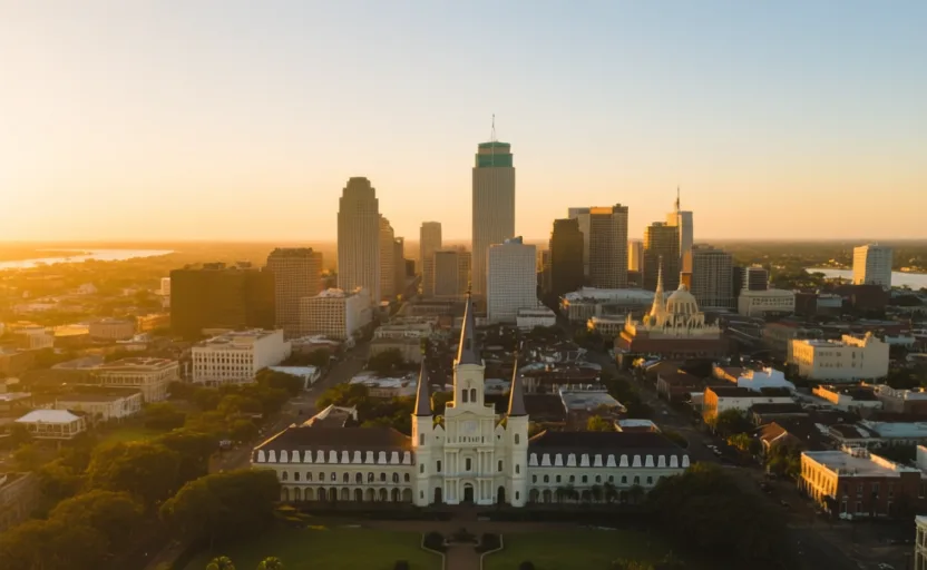
 New Orleans · AI city illustration · Artistic impression
City · North America
New Orleans
Also known as Nouvelle-Orléans, Bulbancha
Saved in this browser — no account needed. Sign in later and it comes with you.
Read its story
Where it is
New Orleans sits on the lower Mississippi about 160 kilometres from the Gulf, on a crescent of the river, with Lake Pontchartrain to the north. Much of the city is at or below sea level and stays dry by pumping — a system of drainage canals and pumps running continuously. The ground is deltaic sediment that compacts as it is drained, so the act of keeping the city dry is also what makes it lower.
The land and water around it
The Mississippiriver
The drain of most of the North American interior, and the reason the city was placed here. Levees now confine it, sending sediment down the channel instead of across the marsh.
Lake Pontchartrainlake
A large brackish estuary north of the city, reached from the river by a short portage. That shortcut is the whole reason for the address.
The coastal wetlandsdelta
Marsh south and east of the city that absorbs storm surge. It is disappearing, because levees stopped the floods that used to rebuild it while compaction and sea-level rise continue.
Its history, in short
France founded the city in 1718 at a short portage between the river and the lake, a route already in use by Indigenous peoples of the region. It passed to Spain, back to France, and to the United States in 1803. It became one of the busiest ports in the Americas, and inseparably one of the largest markets in the domestic trade in enslaved people. Its population layered French, Spanish, African, Haitian, Irish, German, Italian and later Vietnamese arrivals, producing a distinct legal tradition, two French-related languages, and the musical lineage that became jazz. The engineering that protects it — levees along the river, pumps beneath the city — has also removed the sediment supply that built the coast, and the coast is going.
Timeline
Dates are shown on a timeline rather than as changing shapes on the map. The globe draws modern boundaries only, and tinting a modern outline to stand for a historical one would state something we cannot source.
Early modern & oceanic
1718
Founded at a portage
France establishes a settlement on a river crescent near a short overland route to Lake Pontchartrain. The site is chosen for connection; the ground is soft, low and flood-prone.
Well attestedU.S. National Park Service
Industrial & imperial
1803
The Louisiana Purchase
After a period of Spanish administration and a brief return to France, the territory is sold to the United States. The city's legal system retains a civil-law inheritance that Louisiana still has.
Well attestedU.S. National Park Servicec. 1809
Arrivals from Saint-Domingue
Thousands of refugees from the Haitian Revolution — white, free people of colour and enslaved — arrive via Cuba, roughly doubling the city's population and reinforcing its French-speaking and Afro-Caribbean character.
Well attestedU.S. National Park Service1927
The Great Mississippi Flood
A catastrophic flood in the lower valley displaces hundreds of thousands, disproportionately Black communities, and drives a federal flood-control programme that shapes the river for the rest of the century. A levee downriver was deliberately dynamited to relieve pressure on the city.
Well attestedU.S. Geological Survey
Contemporary
2005
Katrina and the floodwall failures
Storm surge causes multiple failures of levees and floodwalls. Subsequent engineering investigations characterised the flooding as an infrastructure and institutional failure rather than simply an unusually large storm. Displacement was long and, for many, permanent.
Well attestedU.S. Geological Survey
Places that carry meaning
Congo Square18th–19th centuries
A place in what is now Louis Armstrong Park where enslaved and free Black people gathered on Sundays to trade, dance and drum. The continuity of African musical practice there is a documented part of the lineage that runs to jazz.
The Vieux Carré18th century onward
The original grid, mostly rebuilt after fires in 1788 and 1794 — which is why its architecture is substantially Spanish-period rather than French, despite the name everyone uses.
The Lower Ninth Ward20th century onward
A predominantly Black neighbourhood severely flooded in 2005 when the Industrial Canal floodwall failed. Its population remains far below the pre-2005 level.
Languages here
Places are usually multilingual. This lists what is actually spoken, not one language per border.
EnglishGermanic family
The dominant language.
Local varieties, including New Orleans English and African American English, have their own long histories and are frequently mischaracterised as departures from a standard rather than as systems.
Louisiana FrenchRomance family
A historic community language, now spoken by relatively few.
Distinct from Louisiana Creole. Both declined sharply under twentieth-century schooling policy that penalised their use, and both are the subject of current revitalisation effort.
Louisiana CreoleFrench-lexifier creole family
A French-lexifier creole language of the region.
A language in its own right, not a dialect of French, and routinely conflated with Louisiana French even in local usage.
VietnameseAustroasiatic family
Spoken by a substantial community in New Orleans East.
Established by refugee resettlement from the mid-1970s. The community's organised, rapid return after 2005 is well documented.
Learn the language here
- 1Understand which languages are spoken hereNew Orleans is multilingual. Start with which languages are used, by whom, and for what — the phrase list only covers one of them.Written by Globe Quest
- 2Learn 14 phrasesCurated everyday phrases for New Orleans, with audio and a written form.Written by Globe Quest
- 3Say them out loudSpeaking practice with pronunciation feedback, one phrase at a time.Globe Quest material, your own additions
- 4Come back to themSpaced review, so what you learned this week is still there next month.Written by Globe Quest
- 5Practise with people: Vietnamese practice · Ho Chi Minh CityAn in-person practice circle. It is a prepared plan and needs a host before it runs.Run by members
- 6Read why the language is what it isThe quest for this place covers how its languages got here and who speaks them.Written by Globe Quest
Check yourself
Why was the city founded on this particular ground?
A short portage linked the river to Lake Pontchartrain and the Gulf
Chosen for connection despite the ground, not because of it.
Why does draining the city make it lower?
Deltaic sediment compacts as it dries out
Drainage lets the sediment consolidate, so the surface subsides — and then needs more pumping.
Worth arguing about
- The levees protect the city and dissolve the coast that protects it from surge. Over what horizon should that be judged?
- After 2005 some neighbourhoods returned and others did not. What decides that, and who makes it?
What we have not established
These are open questions, listed rather than filled in. We would rather show a gap than a plausible guess.
How much of the pre-2005 population has returned, by neighbourhood?
City-wide figures obscure very large differences between neighbourhoods, and the comparison depends on whether you use 2000 census, 2005 estimates or post-storm surveys. We describe the pattern without quoting recovery percentages.
Sources
- National Park Service · New Orleans Jazz National Historical Park: History & CultureU.S. National Park Service · government · checked 2026-09-08
- U.S. Geological Survey · Water Resources Mission AreaU.S. Geological Survey · government · checked 2026-09-08
Reviewed by Globe Quest editorial on 2026-09-08.