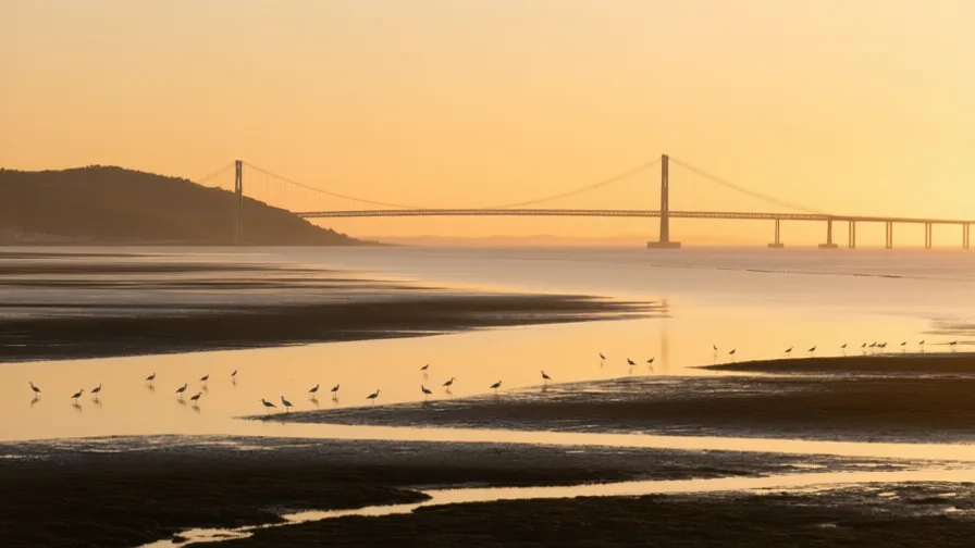
 The Tagus Estuary · AI landscape illustration · Artistic impression
Natural feature · Europe
The Tagus Estuary
Also known as Estuário do Tejo, Mar da Palha
The broad sheltered mouth of the Tagus, giving Lisbon a deep-water harbour close to the open Atlantic.
Saved in this browser — no account needed. Sign in later and it comes with you.
Where it is
The Tagus is Iberia's longest river, and at Lisbon it opens into a broad shallow basin the Portuguese call the Mar da Palha, the Sea of Straw, before narrowing again into a deep channel to the Atlantic. That shape is the point: a large sheltered anchorage, entered through a defensible mouth, sitting almost on the open ocean rather than up a long approach. Lisbon is on the north bank where the hills come down to the water, which is why it is a city of viewpoints and funiculars.
The land and water around it
The Mar da Palhagulf
The wide shallow basin upstream of the narrows, with extensive mudflats. It is a major wintering ground for waders and flamingos, and it is why the harbour is sheltered.
The narrowsstrait
The deep channel between Lisbon and Almada. Defensible, navigable by large ships, and now crossed by the 25 de Abril bridge.
The Lower Tagus valley faultbasin
The valley sits on an active fault system, and the region is exposed both to local earthquakes and to those offshore in the Atlantic. 1755 came from the sea.
Its history, in short
Phoenicians, Romans and Muslims each used the harbour; the Roman name Olisipo and the Arabic al-Ushbuna both survive in Lisboa. Portuguese forces took the city in 1147, and from the fifteenth century the estuary became the departure and return point for the voyages that opened European maritime routes to India and Brazil — with the wealth, and the slave trade, that followed. The 1755 earthquake and tsunami destroyed much of the city and reshaped both its plan and European thinking about disaster. The estuary carried emigration outward and, after 1974, carried people back from the ending empire.
Timeline
Dates are shown on a timeline rather than as changing shapes on the map. The globe draws modern boundaries only, and tinting a modern outline to stand for a historical one would state something we cannot source.
Post-classical world
1147
The siege of Lisbon
Portuguese forces with a fleet of northern crusaders take the city from its Muslim rulers. An eyewitness account of the siege survives, written by one of the participants.
Well attestedEncyclopædia Britannica
Early modern & oceanic
July 1497
Departure for India
Vasco da Gama's fleet leaves from Belém on the estuary's north bank and returns in 1499 having reached India by sea. The Jerónimos monastery was built there afterwards, funded by a tax on the trade that followed.
Well attestedUNESCO World Heritage Centre16th–18th centuries
The trade, and the people in it
The estuary handles spices, then Brazilian sugar and gold. Lisbon was also a major European port of the Atlantic slave trade, with enslaved Africans present in the city in significant numbers from the fifteenth century — a part of the story the monuments to the voyages do not tell.
Well attestedUNESCO World Heritage Centre1 November 1755
Earthquake, fire, wave
A great offshore earthquake on All Saints' Day is followed by fire and by a tsunami up the estuary. Much of the city is destroyed. Estimates of the dead vary widely and no reliable count exists.
DisputedEncyclopædia BritannicaCasualty figures for 1755 come from contemporary estimates made amid the destruction and range from about 10,000 to 100,000. No systematic count was made.
1758 onward
The Baixa Pombalina
The centre is rebuilt on a grid with standardised facades and a timber cage frame designed to survive shaking — among the first purpose-built earthquake-resistant construction in Europe, tested by marching troops on mock-ups.
Well attestedEncyclopædia Britannica
Contemporary
25 April 1974
The Carnation Revolution
A near-bloodless military coup ends the dictatorship. Decolonisation follows quickly, and several hundred thousand people arrive from the former African colonies within about two years — the retornados, who reshaped the estuary's cities.
Well attestedEncyclopædia Britannica1998
Expo and the eastern waterfront
A world exposition on the theme of the oceans converts derelict industrial land upstream into a new district, with the Vasco da Gama bridge across the estuary — the longest in Europe when built.
Well attestedEncyclopædia Britannica
Places that carry meaning
The Tower of Belém1514–1519
A fortified tower at the water's edge, built to defend the approach and to mark the point of departure. Inscribed as World Heritage with the Jerónimos monastery in 1983.
LisbonContinuous
On the north bank where the hills meet the water. Its shape — steep, terraced, with viewpoints — is a consequence of building a port city on that topography.
The Tagus estuary reserveDesignated 1976
One of the largest wetlands in western Europe, on the mudflats east of the city. A capital's estuary that is also a major flyway stop is an unusual combination to have kept.
Languages here
Places are usually multilingual. This lists what is actually spoken, not one language per border.
PortugueseRomance family
The language of the estuary and of a global diaspora.
European Portuguese reduces unstressed vowels heavily, which is why speakers of Brazilian Portuguese often find it harder to follow than the reverse. The voyages from this estuary are why the language is spoken by far more people in Brazil, Angola and Mozambique than in Portugal.
ArabicSemitic family
A historical language of the city, and the source of much of its vocabulary.
Roughly a thousand Portuguese words come from Arabic, many of them beginning with the fossilised article al- — alface, alfândega, algarve. The city's own name passed through Arabic on its way from Latin.
Learn the language here
- 1Understand which languages are spoken hereThe Tagus Estuary is multilingual. Start with which languages are used, by whom, and for what — the phrase list only covers one of them.Written by Globe Quest
- 2Practise with people: Arabic practice · DohaAn in-person practice circle. It is a prepared plan and needs a host before it runs.Run by members
Check yourself
What makes the Tagus estuary a good harbour?
A wide sheltered basin behind a narrow, defensible, deep mouth near the open ocean
Shelter without a long approach — which is exactly what an Atlantic voyage needs at both ends.
What was new about the Baixa rebuilt after 1755?
It used a timber cage frame designed to survive shaking
Among Europe's first purpose-built earthquake-resistant construction, tested on mock-ups before use.
Worth arguing about
- The monuments at Belém commemorate departures. What would a monument to what the ships brought back look like?
- 1755 changed how Europe argued about disaster and providence. When does a catastrophe change how people think, and when does it not?
What we have not established
These are open questions, listed rather than filled in. We would rather show a gap than a plausible guess.
How many people died in 1755?
Contemporary estimates range from about 10,000 to 100,000 and were made amid the destruction, with no systematic count and no reliable population base to work from. We give the range rather than a figure.
Sources
- UNESCO · Monastery of the Hieronymites and Tower of Belém in LisbonUNESCO World Heritage Centre · intergovernmental · checked 2026-09-08
- Britannica · Tagus RiverEncyclopædia Britannica · encyclopedia · checked 2026-09-08
- Britannica · LisbonEncyclopædia Britannica · encyclopedia · checked 2026-09-08
Reviewed by Globe Quest editorial on 2026-09-08.
Related places
Themes: Seas & navigation, Trade & exchange, How cities work