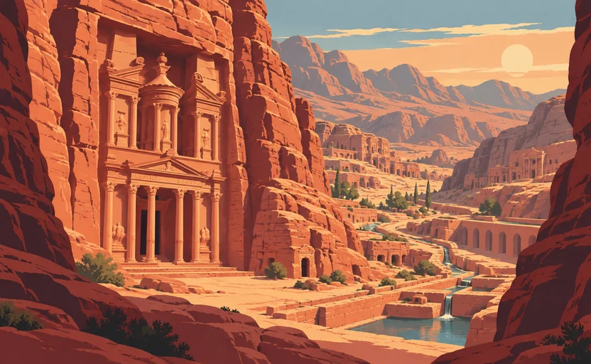
 Petra · AI illustration, not a photograph
Historical place · Middle East
Petra
Also known as Raqmu, al-Batrāʾ
A Nabataean city carved into sandstone in southern Jordan, sustained by engineered water capture in a near-desert.
Saved in this browser — no account needed. Sign in later and it comes with you.
Read its story
Where it is
Petra lies in a basin among sandstone mountains in southern Jordan, on the eastern edge of the Wadi Araba rift. The rock is soft enough to carve and hard enough to hold a facade, and it is banded in reds and creams. The site receives very little rain, and almost all of it falls in short winter storms that arrive as flash floods — which is the central fact about the place, because the Nabataeans built a city here by capturing that water rather than by finding any.
The land and water around it
The Siqstrait
A natural cleft over a kilometre long and in places only a few metres wide, formed by tectonic splitting and then watercourse erosion. It is the main entrance, and it was also a flood channel — which the Nabataeans diverted.
The Nubian sandstoneplateau
Carvable, layered and porous. It gave the tomb facades their surface and their colours, and it holds water badly — which is why the city's engineering is about catching runoff, not tapping aquifers.
Wadi Musariver
The seasonal watercourse through the site. Dry most of the year and dangerous in storm; the Nabataean dam and tunnel that redirected it were rebuilt in the twentieth century after a flash flood killed visitors in the Siq.
Its history, in short
The Nabataeans were an Arabian people who controlled the incense and spice routes from southern Arabia toward the Mediterranean, and Petra was their capital. Their wealth came from moving other people's goods and from knowing where the water was in a desert nobody else could cross reliably. Rome annexed the kingdom in 106 CE. Trade shifted to sea routes and to Palmyra, earthquakes damaged the city, and it faded — kept in use by local Bedouin, and effectively unknown to Europeans until 1812. It is now Jordan's principal visitor site, which brings its own pressures.
Timeline
Dates are shown on a timeline rather than as changing shapes on the map. The globe draws modern boundaries only, and tinting a modern outline to stand for a historical one would state something we cannot source.
Classical world
312 BCE
The first written notice
A Greek account describes a failed Hellenistic raid on a Nabataean stronghold — the earliest textual reference associated with them. Whether the rock it names is Petra itself is argued.
DisputedEncyclopædia BritannicaThe identification of the rock in Diodorus Siculus's account with Petra is a scholarly inference, not a statement in the source.
1st century BCE – 1st century CE
The city at its height
The great carved facades, the theatre and the water system belong mainly to this period. Dating individual monuments is approximate: the facades carry almost no inscriptions saying who made them or when.
Approximate dateUNESCO World Heritage Centre106 CE
Rome annexes Nabataea
The kingdom becomes the province of Arabia Petraea. The city continues, gains a colonnaded street, and is progressively bypassed as trade moves to sea routes and to other overland hubs.
Well attestedEncyclopædia Britannica363 CE
The earthquake
A major earthquake damages much of the region. Petra's decline is usually attributed to a combination of this, later quakes, and the loss of the trade rather than to any single event.
Well attestedEncyclopædia Britannica
Industrial & imperial
1812
Reached by an outsider
Johann Ludwig Burckhardt, travelling in disguise, becomes the first European in centuries to see the site. It was never lost — Bedouin communities had lived there throughout — and describing it as rediscovered erases the people who had never left.
Well attestedEncyclopædia Britannica
Contemporary
1985
Inscribed as World Heritage
Petra is inscribed. In the years around the inscription the Bdoul Bedouin living among the monuments were resettled to a village built above the site, a move they did not choose.
Well attestedUNESCO World Heritage Centre2011
Wadi Rum inscribed
The desert south of Petra is listed as a mixed cultural and natural property, partly for its thousands of rock inscriptions in Nabataean, Thamudic and other early Arabian scripts.
Well attestedUNESCO World Heritage Centre
Places that carry meaning
Al-Khazneh1st century BCE or CE
The facade at the end of the Siq. Its Arabic name means the treasury, from a local story that a pharaoh's gold was hidden in the urn — bullet marks on the urn are from people testing the story. It is almost certainly a royal tomb.
The water systemNabataean
Dams, cisterns, rock-cut channels and ceramic pipes captured winter flood and stored it. The engineering, not the carving, is what made a city possible here.
Umm Sayhoun1980s onward
The village above the site built for the Bdoul when they were moved out of the caves and tombs they had been living in. Their relationship to the site is now largely as workers in its tourism.
Languages here
Places are usually multilingual. This lists what is actually spoken, not one language per border.
Nabataean AramaicSemitic family
The written language of the Nabataean kingdom.
Written in a cursive script that developed into the Arabic alphabet — the direct ancestor of the writing used across the Arab world today. The Nabataeans very probably spoke a form of Arabic while writing Aramaic, a split between speech and script.
ArabicSemitic family
The language of the region today.
Jordanian Arabic in its Bedouin varieties around Petra. The script it is written in descends from the one on the walls here, which makes the site an unusually literal ancestor of its own signage.
Learn the language here
- 1Understand which languages are spoken herePetra is multilingual. Start with which languages are used, by whom, and for what — the phrase list only covers one of them.Written by Globe Quest
- 2Practise with people: Arabic practice · DohaAn in-person practice circle. It is a prepared plan and needs a host before it runs.Run by members
- 3Read why the language is what it isThe quest for this place covers how its languages got here and who speaks them.Written by Globe Quest
Check yourself
What made a city possible at Petra?
Engineering that captured and stored winter flash floods
Dams, channels and cisterns turned short violent storms into a year-round supply. The carving is the visible half; the plumbing is the reason.
Why does Nabataean writing matter beyond Petra?
Its cursive script developed into the Arabic alphabet
The Arabic script in use today descends from Nabataean cursive Aramaic.
Worth arguing about
- Petra was never lost, but it is described as rediscovered. Who gets to be the person who finds a place?
- People living in a heritage site were moved out to protect it. What is owed to them?
What we have not established
These are open questions, listed rather than filled in. We would rather show a gap than a plausible guess.
When were the major facades carved?
The tombs carry almost no dedicatory inscriptions, so dating rests on stylistic comparison and on the few excavated contexts. Ranges of a century or more are normal and we give them as such.
Sources
- UNESCO · PetraUNESCO World Heritage Centre · intergovernmental · checked 2026-09-08
- UNESCO · Wadi Rum Protected AreaUNESCO World Heritage Centre · intergovernmental · checked 2026-09-08
- Britannica · PetraEncyclopædia Britannica · encyclopedia · checked 2026-09-08
Reviewed by Globe Quest editorial on 2026-09-08.
Related places
Themes: Trade & exchange, Water & environment, Mountains, deserts & islands