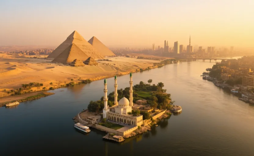
 Cairo · AI city illustration · Artistic impression
City · Africa
Cairo
Also known as al-Qāhira, Fustat, القاهرة
Saved in this browser — no account needed. Sign in later and it comes with you.
Read its story
Where it is
Cairo sits at the point where the Nile valley opens into the delta — the hinge of Egypt, with the narrow valley upstream and the fan of cultivated land downstream. The Muqattam hills rise to the east, the desert plateau and the Giza pyramid field lie to the west across the river. Its metropolitan area is among the largest in Africa and the Arab world, and it has grown outward onto desert land in planned satellite cities because the cultivated land it would otherwise take is the only cultivated land there is.
The land and water around it
The Nileriver
The reason the city exists and the axis it is organised on. The annual flood ended with the Aswan High Dam in 1970, which changed the river's behaviour through the city as well as downstream.
The valley–delta junctiondelta
Upstream the cultivable strip is a few kilometres wide; downstream it fans out. A capital placed here controls both.
The Muqattam hillsplateau
Limestone escarpment east of the city, quarried for building stone since antiquity and now overlooked by the Citadel.
Its history, in short
The hinge has held a capital for most of five thousand years, though not always the same one and not always on the same spot. Memphis stood near the junction in the Old Kingdom. After the Arab conquest the garrison town of Fustat was founded on the east bank in 641, and in 969 the Fatimids laid out a new walled city beside it — al-Qahira, from which the European name comes. Successive dynasties built outward and over: Ayyubid citadel, Mamluk mosques and madrasas, Ottoman quarters, then a nineteenth-century European-style district laid out under Isma'il, then twentieth-century expansion at a scale none of the earlier layers anticipated.
Timeline
Dates are shown on a timeline rather than as changing shapes on the map. The globe draws modern boundaries only, and tinting a modern outline to stand for a historical one would state something we cannot source.
First cities & states
c. 2600–2500 BCE
Memphis and the pyramid fields
The Old Kingdom capital stands near the junction, with cemeteries and pyramid fields running from Giza to Dahshur on the desert edge west of the river.
Approximate dateUNESCO World Heritage Centre
Post-classical world
641
Fustat founded
A garrison town is established on the east bank after the Arab conquest, becoming Egypt's administrative centre and a major commercial city.
Well attestedUNESCO World Heritage Centre969
Al-Qahira laid out
The Fatimids found a new walled palace-city beside Fustat. Al-Azhar is established shortly after and becomes a centre of Islamic learning that is still operating.
Well attestedUNESCO World Heritage Centre1176 onward
The Citadel
Saladin begins a fortress on a spur of the Muqattam. It remains the seat of government for some seven hundred years, which is a long time for one building to hold a state.
Well attestedUNESCO World Heritage Centre
Industrial & imperial
1860s–70s
A European quarter
Khedive Isma'il lays out a new district on drained land west of the medieval city, with boulevards and apartment blocks on Parisian lines, timed to the opening of the Suez Canal.
Well attestedUNESCO World Heritage Centre
Contemporary
1979
Historic Cairo inscribed
The medieval city is inscribed as World Heritage — an area rather than a monument, because the value claimed is the accumulated, still-inhabited urban fabric.
Well attestedUNESCO World Heritage Centre
Places that carry meaning
Al-Azhar970 onward
A Fatimid foundation that became a centre of Sunni learning and is among the longest continuously operating institutions of higher education anywhere.
The Giza pyramid fieldc. 2600–2500 BCE
On the desert plateau across the river, now at the edge of the built-up city rather than in isolated desert — the suburbs reached them.
The City of the DeadMedieval onward
Extensive cemeteries east and south of the historic city, with mausolea and tomb enclosures, parts of which have long been inhabited. Recent road construction through them has been contested.
Languages here
Places are usually multilingual. This lists what is actually spoken, not one language per border.
Egyptian ArabicSemitic family
The everyday spoken language of the city.
Widely understood across the Arabic-speaking world because of a century of Egyptian film, radio and television — a rare case of a spoken variety travelling on media rather than on migration.
Modern Standard ArabicSemitic family
The written and formal register.
Used in print, news and official settings, and not the language anyone speaks at home. The gap between written and spoken Arabic is a fact about the language, not a shortcoming of its speakers.
CopticEgyptian family
Liturgical language of the Coptic Orthodox Church.
The last stage of the ancient Egyptian language, written in a Greek-derived alphabet. No longer anyone's first language, and in continuous liturgical use.
Learn the language here
- 1Understand which languages are spoken hereCairo is multilingual. Start with which languages are used, by whom, and for what — the phrase list only covers one of them.Written by Globe Quest
- 2Learn 12 phrasesCurated everyday phrases for Cairo, with audio and a written form.Written by Globe Quest
- 3Say them out loudSpeaking practice with pronunciation feedback, one phrase at a time.Globe Quest material, your own additions
- 4Come back to themSpaced review, so what you learned this week is still there next month.Written by Globe Quest
- 5Practise with people: Arabic practice · DohaAn in-person practice circle. It is a prepared plan and needs a host before it runs.Run by members
- 6Read why the language is what it isThe quest for this place covers how its languages got here and who speaks them.Written by Globe Quest
Check yourself
Why has a capital repeatedly been placed near this spot?
It is the hinge between the narrow valley and the delta, controlling both
Memphis, Fustat and al-Qahira are all at or near the junction, for the same reason.
Why is the heritage inscription for an area rather than a monument?
The value is the accumulated, still-used urban fabric
Street pattern, layering and continuing use are the claim, not one finest example.
Worth arguing about
- Cairo expands onto desert because the alternative is building on the only farmland Egypt has. Is that the right trade?
- A medieval city where people still live is harder to conserve than an empty one. Who should decide what may change?
What we have not established
These are open questions, listed rather than filled in. We would rather show a gap than a plausible guess.
How many people live in Greater Cairo?
Estimates differ by several million depending on whether they count the governorate, the built-up area or the wider metropolitan region, and Egypt's census intervals are long. We describe the scale rather than quoting a number without a boundary.
How many people live in the City of the Dead?
Figures ranging from tens of thousands to over a million circulate, resting on different definitions of the area and of residence. No reliable count exists that we could cite.
Sources
- UNESCO · Historic CairoUNESCO World Heritage Centre · intergovernmental · checked 2026-09-08
- UNESCO · Memphis and its Necropolis – the Pyramid Fields from Giza to DahshurUNESCO World Heritage Centre · intergovernmental · checked 2026-09-08
- NASA Earth Observatory · The Nile Delta's Disappearing FarmlandNASA Earth Observatory · government · checked 2026-09-08
Reviewed by Globe Quest editorial on 2026-09-08.