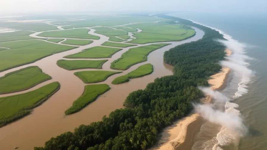
 The Bengal Delta · AI landscape illustration · Artistic impression
Natural feature · South Asia
The Bengal Delta
Also known as Ganges–Brahmaputra delta, Sundarbans
The world's largest river delta, built by the Ganges and Brahmaputra and home to tens of millions.
Saved in this browser — no account needed. Sign in later and it comes with you.
Where it is
The Bengal delta is the largest river delta on Earth, built by the Ganges and Brahmaputra where they meet and spread across Bangladesh and West Bengal before reaching the Bay of Bengal. It is enormous, extremely flat, and very densely populated — tens of millions of people living a couple of metres above sea level on ground the rivers are still making. At its seaward edge is the Sundarbans, the largest mangrove forest in the world, straddling the India–Bangladesh border.
The land and water around it
The Sundarbansforest
Mangrove forest at the delta's seaward margin, split by the border. It absorbs storm surge before it reaches inhabited land, and it depends on a particular balance of fresh and salt water that upstream diversion changes.
The Hooghlyriver
A western distributary, and the channel the East India Company used. It has been silting for centuries; a barrage at Farakka diverts Ganges flow into it to keep it navigable.
The Meghna estuarydelta
The delta's main outlet today, carrying the combined Ganges and Brahmaputra. Its position reflects the eastward migration of the main flow.
Its history, in short
The delta's channels have never held still: the main flow has shifted east across the delta over the past few centuries, abandoning some cities and creating others. Bengal was among the wealthiest regions of the Mughal Empire, exporting textiles at a scale that made its name a byword for cloth, and was the first part of India brought under East India Company rule after 1757. Its modern history is defined by two divisions — the partition of 1947 and the war of 1971 — and by an ongoing negotiation with water that is now complicated by upstream barrages, cyclones and sea-level rise.
Timeline
Dates are shown on a timeline rather than as changing shapes on the map. The globe draws modern boundaries only, and tinting a modern outline to stand for a historical one would state something we cannot source.
Post-classical world
13th–17th centuries
The channels move east
The main flow of the Ganges shifts progressively eastward across the delta over several centuries. Ports and capitals that depended on the old channels decline; new ones appear on the new ones. Dating this migration is approximate and drawn from a mix of textual and sedimentary evidence.
Early modern & oceanic
1757
Plassey
The East India Company defeats the Nawab of Bengal, beginning the Company's territorial rule in India. Bengal's revenue funds much of what follows across the subcontinent.
Well attestedEncyclopædia Britannica
Industrial & imperial
1943
The Bengal famine
Around three million people die. Grain was available in the region; the causes argued over include wartime procurement, the halting of Burmese imports, price inflation, boat requisitioning and the British administration's refusal to divert shipping. Where responsibility lies is contested and remains politically live.
DisputedEncyclopædia BritannicaThe famine's causes and the extent of British administrative responsibility are argued between historians and remain politically charged in Britain, India and Bangladesh. The scale of mortality is not disputed.
Contemporary
1947
Bengal is partitioned
The delta is divided: Calcutta stays in India, the eastern districts become East Pakistan. Millions move in both directions, and the border separates jute fields from the mills that processed them.
Well attestedEncyclopædia BritannicaNovember 1970
The Bhola cyclone
A cyclone and storm surge kill several hundred thousand people in the delta — among the deadliest tropical cyclones on record. The Pakistani government's response deepened East Pakistani grievance and fed into the war the following year.
Well attestedEncyclopædia Britannica1971
Bangladesh
War ends with the independence of Bangladesh. The delta is now divided between two sovereign states that must negotiate over water that ignores the line.
Well attestedEncyclopædia Britannica1975 onward
Farakka, and the dry-season argument
India's Farakka barrage diverts Ganges flow into the Hooghly upstream of the border. Bangladesh receives less dry-season water as a result; treaties have been negotiated and renegotiated since, most substantially in 1996.
Well attestedEncyclopædia Britannica
Places that carry meaning
Kolkata1690s onward
Founded on the Hooghly because the channel was then navigable far inland for ocean-going ships. The channel silted, the port's activity moved downstream, and the city stayed.
The SundarbansPresent day
Inscribed as World Heritage on both sides of the border under separate listings. Home to a tiger population, and to people who enter the forest for honey and fish and sometimes do not return.
Languages here
Places are usually multilingual. This lists what is actually spoken, not one language per border.
BengaliIndo-Aryan family
The language of the whole delta, on both sides of the border.
The border cut a single language region in two. Language is also why Bangladesh exists: the imposition of Urdu as Pakistan's sole national language produced the Bengali Language Movement, whose 1952 killings are commemorated on 21 February — now International Mother Language Day.
Chittagonian and SylhetiIndo-Aryan family
Spoken in the delta's eastern and north-eastern districts.
Usually classed officially as Bengali dialects and not readily mutually intelligible with standard Bengali — the recurring question of what separates a language from a dialect, answered here by administration rather than by linguistics.
Learn the language here
Check yourself
What has the delta's main channel done over recent centuries?
Migrated progressively eastward, stranding some ports and creating others
Delta channels are not fixed addresses, which is why Kolkata's founding advantage expired.
What was the Bengali Language Movement about?
Opposing the imposition of Urdu as Pakistan's sole national language
The 1952 protests and killings are commemorated internationally, and the movement fed directly into Bangladeshi independence.
Worth arguing about
- A single language region divided by a border, negotiating over a river that ignores it. What should govern a shared delta?
- Bangladesh exists partly because of a language dispute. Where else has language been the fault line rather than the symptom?
What we have not established
These are open questions, listed rather than filled in. We would rather show a gap than a plausible guess.
How fast is the delta losing or gaining land?
Sediment supply, subsidence, embankment and sea-level rise all act at once and in different directions in different places, so basin-wide figures conceal more than they show. We describe the processes rather than quoting a net rate.
Sources
- UNESCO · The SundarbansUNESCO World Heritage Centre · intergovernmental · checked 2026-09-08
- NASA Earth Observatory · Sundarbans, BangladeshNASA Earth Observatory · government · checked 2026-09-08
- NASA Earth Observatory · World of Change: Padma RiverNASA Earth Observatory · government · checked 2026-09-08
- Britannica · Ganges RiverEncyclopædia Britannica · encyclopedia · checked 2026-09-08
- Britannica · Battle of PlasseyEncyclopædia Britannica · encyclopedia · checked 2026-09-08
- Britannica · Bengal famine of 1943Encyclopædia Britannica · encyclopedia · checked 2026-09-08
- Britannica · BangladeshEncyclopædia Britannica · encyclopedia · checked 2026-09-08
Reviewed by Globe Quest editorial on 2026-09-08.
Related places
Themes: Rivers & cities, Water & environment, How cities work, Migration & diaspora