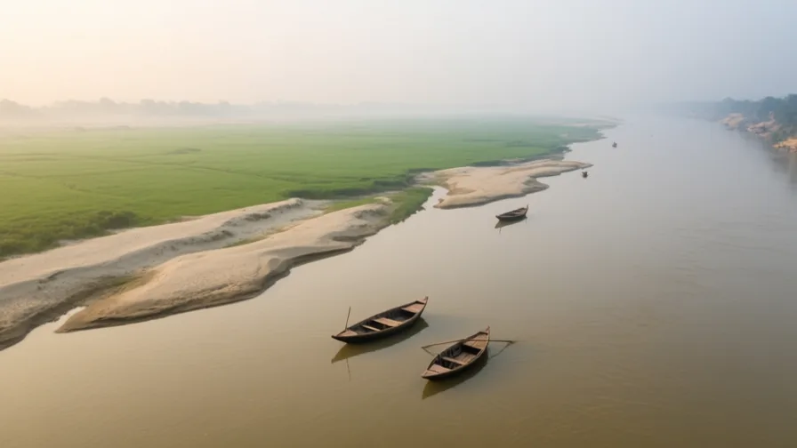
 The Ganges · AI landscape illustration · Artistic impression
Natural feature · South Asia
The Ganges
Also known as Ganga, Padma
A major river of northern India, central to Hindu practice and to the agriculture of the plains it crosses.
Saved in this browser — no account needed. Sign in later and it comes with you.
Where it is
The Ganges rises in the western Himalaya and runs roughly south-east across the northern Indian plain, gathering very large tributaries — the Yamuna, the Ghaghara, the Gandak, the Kosi — before joining the Brahmaputra in Bangladesh and reaching the Bay of Bengal through the largest delta on Earth. The plain it crosses is flat, deep in alluvium, and among the most densely populated agricultural regions anywhere. Its flow is strongly seasonal: most of the year's water arrives with the summer monsoon, with Himalayan snow and ice contributing more in the dry months than the annual totals suggest.
The land and water around it
The Gangetic plainbasin
A vast, almost flat alluvial plain built by the river and its tributaries. Its gradient is so slight that the channels wander, which is why settlement patterns here are inseparable from where the water was last century.
The Bengal Deltadelta
Where the Ganges and Brahmaputra meet the sea, across Bangladesh and West Bengal. Sediment supply, freshwater flow and tidal salinity all meet here, and all three are affected by decisions taken hundreds of kilometres upstream.
The Sundarbansforest
The mangrove forest at the delta's seaward edge, straddling the India–Bangladesh border. It buffers storm surge and depends on a particular balance of fresh and salt water.
Its history, in short
The river has been the axis of northern Indian settlement, agriculture and religious practice for millennia, with cities strung along it and pilgrimage organised around specific points on its banks. Its modern history is a history of engineering: canal systems from the nineteenth century, barrages that divert flow between distributaries, and cleaning programmes since 1986 that have repeatedly been relaunched. The two are connected — the same works that made the plain more productive also changed what the river could carry away.
Timeline
Dates are shown on a timeline rather than as changing shapes on the map. The globe draws modern boundaries only, and tinting a modern outline to stand for a historical one would state something we cannot source.
Classical world
c. 8th–2nd centuries BCE
Cities on the plain
Urban centres develop along the Ganges and its tributaries during the second wave of South Asian urbanisation, after the Indus cities and in a different river system.
Approximate dateUNESCO World Heritage Centre
Industrial & imperial
1854
The Ganges Canal opens
A large irrigation canal taking water from the river at Haridwar begins operating, the start of the era in which the river's flow is allocated rather than simply used.
Well attestedEncyclopædia Britannica
Contemporary
1975
The Farakka barrage begins operating
A barrage upstream of the Bangladesh border diverts part of the flow into the Hooghly to keep Kolkata's channel navigable. It becomes a long-running dispute with Bangladesh over dry-season flow, addressed by treaties that have been negotiated and renegotiated.
Well attestedUNESCO World Heritage Centre1986
The first Ganga Action Plan
India launches a major river-cleaning programme, the first of several. Improvement has been partial: sewage generation has outpaced treatment capacity, plants require continuous power and maintenance, industrial discharge is dispersed, and responsibility is split across the states the river crosses.
Well attestedEncyclopædia Britannica2008
Declared a national river
India designates the Ganges a national river, creating a basin authority. The designation is administrative; it does not by itself change any of the structural constraints above.
Well attestedEncyclopædia Britannica
Places that carry meaning
VaranasiFirst millennium BCE onward
On the river's high outer bank at a bend where it briefly runs north. Its ghats are stepped access to water whose level changes by metres between seasons, and cremation grounds sit directly on the water.
HaridwarLong-standing practice
Where the river leaves the mountains for the plain, and a major pilgrimage point. The Ganges Canal takes its water from here, so the same location is both a religious threshold and a hydraulic one.
Languages here
Places are usually multilingual. This lists what is actually spoken, not one language per border.
HindiIndo-Aryan family
The dominant language across the middle Ganges plain and an official language of India.
Standard Hindi is an official register; what people actually speak along the river varies considerably from it and from place to place.
BhojpuriIndo-Aryan family
Widely spoken in the eastern Gangetic plain, including around Varanasi.
Often officially treated as a Hindi dialect and by its speakers as a language in its own right. Which of those it is has been a live political question for decades, and no linguistic test settles it.
BengaliIndo-Aryan family
The language of the delta, in both West Bengal and Bangladesh.
A border runs through the Bengali-speaking region; the language does not stop at it, which is one reason the delta's water politics are also identity politics.
SanskritIndo-Aryan family
Liturgical and scholarly language, not a community's first language.
The language of much of the textual tradition attached to the river, still used in ritual and taught in specialist institutions along it.
Learn the language here
Check yourself
Why does Himalayan ice matter more than its share of annual flow suggests?
Because it contributes disproportionately in the dry season, when there is least other water
Annual totals are dominated by the monsoon, but dry-season flow is when the marginal contribution matters most.
Why has cleaning the river proved so hard?
Because capacity, maintenance, dispersed industry and split jurisdiction all bind at once
It is a governance problem wearing an engineering costume — building plants is the part that was solved.
Worth arguing about
- A river that is sacred, a water supply and a drain at the same time. When those uses conflict, whose claim should win?
- Farakka helps Kolkata and reduces Bangladesh's dry-season flow. What principle should govern a river that crosses a border?
What we have not established
These are open questions, listed rather than filled in. We would rather show a gap than a plausible guess.
What share of the river's dry-season flow now comes from glacier melt?
Published estimates vary widely with the definition of 'dry season', the reach measured and the modelling approach. We have not identified a single figure we could cite responsibly, so the dossier states the direction of the effect and not a percentage.
Sources
- UNESCO · The SundarbansUNESCO World Heritage Centre · intergovernmental · checked 2026-09-08
- UNESCO · Kathmandu ValleyUNESCO World Heritage Centre · intergovernmental · checked 2026-09-08
- UNESCO · Archaeological Ruins at MoenjodaroUNESCO World Heritage Centre · intergovernmental · checked 2026-09-08
- NASA Earth Observatory · Flooding on the Ganges RiverNASA Earth Observatory · government · checked 2026-09-08
- Britannica · Ganges RiverEncyclopædia Britannica · encyclopedia · checked 2026-09-08
Reviewed by Globe Quest editorial on 2026-09-08.
Related places
Themes: Rivers & cities, Religion & pilgrimage, Water & environment, How cities work