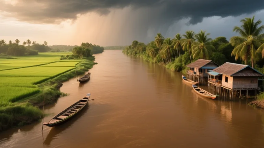
 The Mekong · AI landscape illustration · Artistic impression
Natural feature · Southeast Asia
The Mekong
Also known as Mènam Khong, Sông Cửu Long, Lancang
A river crossing six countries from the Tibetan Plateau to a delta in southern Vietnam.
Saved in this browser — no account needed. Sign in later and it comes with you.
Where it is
The Mekong rises on the Tibetan Plateau and runs about 4,900 kilometres through China, along the Myanmar and Laos borders, through Laos, Thailand and Cambodia, and into the sea through a delta in southern Vietnam. Six countries, and a flow regime dominated by the monsoon: most of the year's water arrives in a few months. Its most unusual feature is the Tonlé Sap in Cambodia, a lake whose feeder river reverses direction each wet season as the Mekong backs up into it, expanding the lake several-fold and then draining it again.
The land and water around it
The Tonlé Saplake
A lake in central Cambodia connected to the Mekong by a river that reverses each monsoon. The flood pulse drives one of the most productive inland fisheries anywhere, and it depends on the river rising enough to push water back into it.
The Mekong Deltadelta
A low, intensively farmed delta in southern Vietnam laced with distributaries and canals. Rice, fruit and aquaculture, on ground barely above sea level.
The Khone Fallsriver
A wide series of rapids and cataracts near the Laos–Cambodia border. They are why the river is not navigable through to China, and they defeated the French expedition that went looking for a route.
Its history, in short
The river fed the Khmer Empire's rice economy, carried French colonial ambitions upstream in the nineteenth century — an expedition that established, expensively, that the Mekong is not navigable from the sea to China — and now supports one of the world's largest inland fisheries and a very large delta agriculture. Its modern history is a dispute about who gets to change the flow. China has built a cascade of large dams on the upper river; Laos has built and is building more on the mainstream; and the countries downstream depend on a flood pulse that those dams smooth out.
Timeline
Dates are shown on a timeline rather than as changing shapes on the map. The globe draws modern boundaries only, and tinting a modern outline to stand for a historical one would state something we cannot source.
Post-classical world
9th–15th centuries
The Khmer Empire on the flood pulse
Angkor's rice economy is built on the seasonal water of the Mekong system and the Tonlé Sap, managed through reservoirs and canals.
Well attestedUNESCO World Heritage Centre
Industrial & imperial
1866–68
The Mekong Exploration Commission
A French expedition travels upriver hoping to find a trade route to China. It establishes that the rapids make the river unusable for that purpose — an expensive negative result that redirected French attention to the Red River in the north.
Well attestedUNESCO World Heritage Centre
Contemporary
1995
The Mekong River Commission
Cambodia, Laos, Thailand and Vietnam sign an agreement establishing a body for cooperation on the lower basin. China and Myanmar are dialogue partners rather than members, which limits what it can settle.
Well attestedEncyclopædia Britannica2010s onward
Dams, and an argument about the flood
A cascade of large dams on the Chinese upper river and mainstream dams in Laos change the timing and size of the flood pulse and hold back sediment. Downstream governments, fishers and delta farmers attribute low flows and reduced sediment to them; upstream operators point to drought. Both drought and dam operation affect flow, and disentangling their contributions is genuinely contested.
Attribution of low flows and reduced sediment between dam operation and drought is disputed between riparian governments, the Mekong River Commission and independent researchers. That both factors operate is not in dispute; their relative weight is.
Places that carry meaning
Angkor9th–15th centuries
North of the Tonlé Sap, built around an engineered water landscape that redistributed the monsoon across the year.
The Cửu Long distributariesPresent day
The Vietnamese name for the delta means Nine Dragons, for the river mouths. Fewer than nine now reach the sea, which is itself a record of how the delta has changed.
Languages here
Places are usually multilingual. This lists what is actually spoken, not one language per border.
KhmerAustroasiatic family
The language of Cambodia, through which the river's middle course runs.
Also spoken by Khmer Krom communities in the Vietnamese delta, whose presence there predates the current border.
Lao and ThaiKra-Dai family
Spoken along the middle river, which forms much of the Laos–Thailand border.
Closely related and substantially mutually intelligible in their central varieties — a border that separates states more than it separates speech.
VietnameseAustroasiatic family
The language of the delta.
Written in a Latin-based alphabet with tone marks, adapted by missionaries and adopted officially in the twentieth century in place of Chinese characters and the chữ Nôm script.
Learn the language here
- 1Understand which languages are spoken hereThe Mekong is multilingual. Start with which languages are used, by whom, and for what — the phrase list only covers one of them.Written by Globe Quest
- 2Practise with people: Vietnamese practice · Ho Chi Minh CityAn in-person practice circle. It is a prepared plan and needs a host before it runs.Run by members
Check yourself
What is unusual about the Tonlé Sap?
Its feeder river reverses direction each monsoon, expanding the lake several-fold
The Mekong backs up into it in the wet season and it drains again in the dry — the flood pulse the fishery depends on.
What is genuinely contested about the Mekong's recent low flows?
How much of the change is dam operation and how much is drought
Both factors operate. Their relative contribution is disputed between governments and researchers.
Worth arguing about
- Six countries share this river and only four are in the commission. What would a body that could actually settle a dispute look like?
- A flood that farmers, fishers and a lake all depend on is also a flood that dams exist to remove. Whose interest should set the release schedule?
What we have not established
These are open questions, listed rather than filled in. We would rather show a gap than a plausible guess.
How much sediment now reaches the Mekong Delta compared with before the dams?
Published reductions vary widely with the measuring station, the period and the modelling approach, and the question is politically charged among riparian states. We describe the mechanism and the dispute rather than quoting a percentage.
Sources
- UNESCO · AngkorUNESCO World Heritage Centre · intergovernmental · checked 2026-09-08
- UNESCO · Complex of Hué MonumentsUNESCO World Heritage Centre · intergovernmental · checked 2026-09-08
- Britannica · Mekong RiverEncyclopædia Britannica · encyclopedia · checked 2026-09-08
- NASA Earth Observatory · Mekong Floods Fill Tônlé SapNASA Earth Observatory · government · checked 2026-09-08
- NASA Earth Observatory · Angkor, CambodiaNASA Earth Observatory · government · checked 2026-09-08
Reviewed by Globe Quest editorial on 2026-09-08.
Related places
Themes: Rivers & cities, Water & environment, Trade & exchange