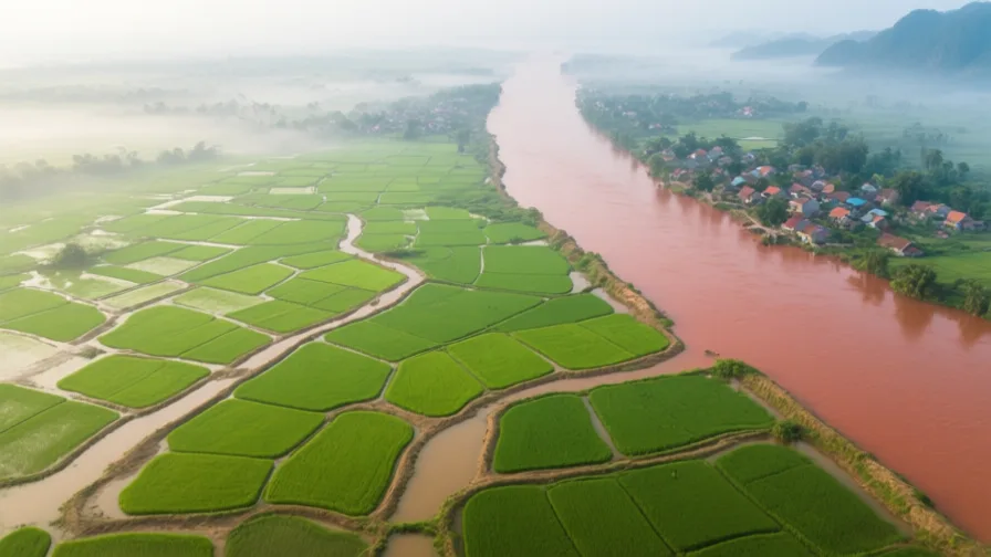
 Red River Delta · AI landscape illustration · Artistic impression
Natural feature · Southeast Asia
Red River Delta
Also known as Đồng bằng sông Hồng, Sông Hồng delta
The densely settled floodplain of northern Vietnam, and the agricultural base Hanoi grew from.
Saved in this browser — no account needed. Sign in later and it comes with you.
Where it is
The Red River delta occupies the flat lowland of northern Vietnam, built by the Hồng river and its tributaries out of sediment carried from the mountains of Yunnan and northern Vietnam. It is small compared with the Mekong delta to the south and among the most densely settled agricultural landscapes anywhere. The river carries so much sediment that its bed rises, so it has been embanked for a thousand years and in places now runs above the surrounding fields.
The land and water around it
The dyke networkriver
Embankments running for thousands of kilometres, built up over a millennium. They confine the river, which then deposits sediment on its own bed and rises further, requiring higher dykes. The system works only while it is maintained.
Hạ Long Baysea
Limestone karst towers rising from the sea at the delta's north-eastern edge, formed by the drowning of an eroded limestone landscape. Geologically the delta's neighbour rather than part of it.
The Tonkin lowlandbasin
The delta plain itself: intensively cultivated wet rice, with village clusters on slightly raised ground and a settlement density that has shaped Vietnamese social organisation for centuries.
Its history, in short
This delta is the historic heartland of the Vietnamese state. It was under Chinese rule for roughly a thousand years, which left the administrative vocabulary, the examination system and the characters, and it produced independence movements repeatedly until one succeeded in the tenth century. Thăng Long, now Hanoi, was founded here in 1010 and has been the seat of power more often than not since. The dyke system that keeps the delta habitable was built and maintained by successive states as a core function, and it remains one.
Timeline
Dates are shown on a timeline rather than as changing shapes on the map. The globe draws modern boundaries only, and tinting a modern outline to stand for a historical one would state something we cannot source.
Classical world
111 BCE – 938 CE
A thousand years of Chinese rule
The delta is administered as a Chinese province for roughly a millennium, with repeated revolts. The period leaves the writing system, the bureaucratic model and a great deal of vocabulary, alongside a durable tradition of resisting northern control.
Well attestedEncyclopædia Britannica
Post-classical world
938
Bạch Đằng
Ngô Quyền defeats a Chinese fleet on the Bạch Đằng river, reportedly using tide-timed stakes driven into the riverbed, and independence follows. The tactic was used again on the same river in 1288 against Mongol forces.
Well attestedEncyclopædia Britannica1010
Thăng Long founded
The Lý dynasty moves its capital to the site of modern Hanoi. Excavation of the citadel's central sector has found layers from successive dynasties in one place.
Well attestedUNESCO World Heritage Centrec. 1400
The Hồ dynasty builds elsewhere
A new stone citadel is built away from Thăng Long. The dynasty is short-lived and the capital returns, which is itself evidence of how strong the delta site's pull is.
Well attestedUNESCO World Heritage Centre
Industrial & imperial
1883–1954
French Tonkin
The delta becomes the core of French Tonkin, with Hanoi as the capital of the Indochinese Union. Rail and roads are laid out to move goods to ports rather than to link Vietnamese regions to each other.
Well attestedEncyclopædia Britannica
Contemporary
1944–45
The famine
Between several hundred thousand and two million people die in the delta and northern Vietnam. Causes argued over include Japanese and French requisitioning, the diversion of land from rice to industrial crops, floods, and the disruption of transport. Estimates and attribution both remain contested.
DisputedEncyclopædia BritannicaMortality estimates for the 1944–45 famine range widely, and responsibility is attributed differently by Vietnamese, French and Japanese accounts. Both the figure and the attribution are contested.
Places that carry meaning
The Imperial Citadel of Thăng Long1010 onward
The central sector holds stratified remains from successive dynasties on one site — the archaeology of political continuity, literally stacked.
Hanoi's Old Quarter15th century onward
Streets historically named for the trade practised on them — silk, tin, baskets, paper. A guild geography still legible in the street signs.
Languages here
Places are usually multilingual. This lists what is actually spoken, not one language per border.
VietnameseAustroasiatic family
The national language; the northern variety is the standard.
Written for centuries in Chinese characters and in chữ Nôm, a Vietnamese-specific character script, before the Latin-based quốc ngữ became standard in the twentieth century. That change made literacy far easier to spread and cut most readers off from the older written record.
Literary ChineseSinitic family
The administrative and scholarly written language for most of the delta's history.
Used in government and examinations until the early twentieth century — written, not spoken, and a good example of a written language that was nobody's mother tongue.
Tày and NùngKra-Dai family
Spoken in the uplands around the delta's northern edge.
Among Vietnam's larger minority languages. The delta is Kinh-majority; the mountains around it are not, and that distinction runs through Vietnamese history.
Learn the language here
- 1Understand which languages are spoken hereRed River Delta is multilingual. Start with which languages are used, by whom, and for what — the phrase list only covers one of them.Written by Globe Quest
- 2Practise with people: Vietnamese practice · Ho Chi Minh CityAn in-person practice circle. It is a prepared plan and needs a host before it runs.Run by members
Check yourself
Why does embanking a sediment-rich river raise its bed?
Sediment that would have spread across the floodplain settles inside the dykes instead
Confinement concentrates deposition in the channel, so the bed rises and the dykes must rise with it.
What did the shift to the Latin-based quốc ngữ script do?
Made literacy far easier to spread, and cut most readers off from older texts
An alphabet is quicker to learn than characters, and the earlier written record becomes unreadable to most people within a generation.
Worth arguing about
- A dyke system nobody alive chose, that cannot be abandoned. Who should pay to maintain inherited infrastructure?
- Changing a writing system spreads literacy and severs a record. Was it worth it?
What we have not established
These are open questions, listed rather than filled in. We would rather show a gap than a plausible guess.
How many people died in the 1944–45 famine?
Estimates range from around 400,000 to two million. Vietnamese, French and Japanese sources differ on both the figure and the attribution, and no census-quality data exists for the period.
Sources
- UNESCO · Central Sector of the Imperial Citadel of Thang Long - HanoiUNESCO World Heritage Centre · intergovernmental · checked 2026-09-08
- UNESCO · Citadel of the Ho DynastyUNESCO World Heritage Centre · intergovernmental · checked 2026-09-08
- UNESCO · Ha Long BayUNESCO World Heritage Centre · intergovernmental · checked 2026-09-08
- Britannica · VietnamEncyclopædia Britannica · encyclopedia · checked 2026-09-08
Reviewed by Globe Quest editorial on 2026-09-08.
Related places
Themes: Rivers & cities, Water & environment, How cities work, Empires & independence